The Yading Nature Reserve in the Kham region of Sichuan is one of the most beautiful places on the Tibetan Plateau. Read this post for information on how to visit, and trek, this region.
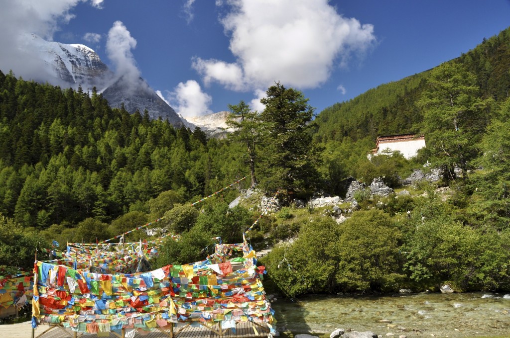
Yading Nature Reserve in the Kham region of Sichuan province
Yading Nature Reserve
UPDATED January 2017
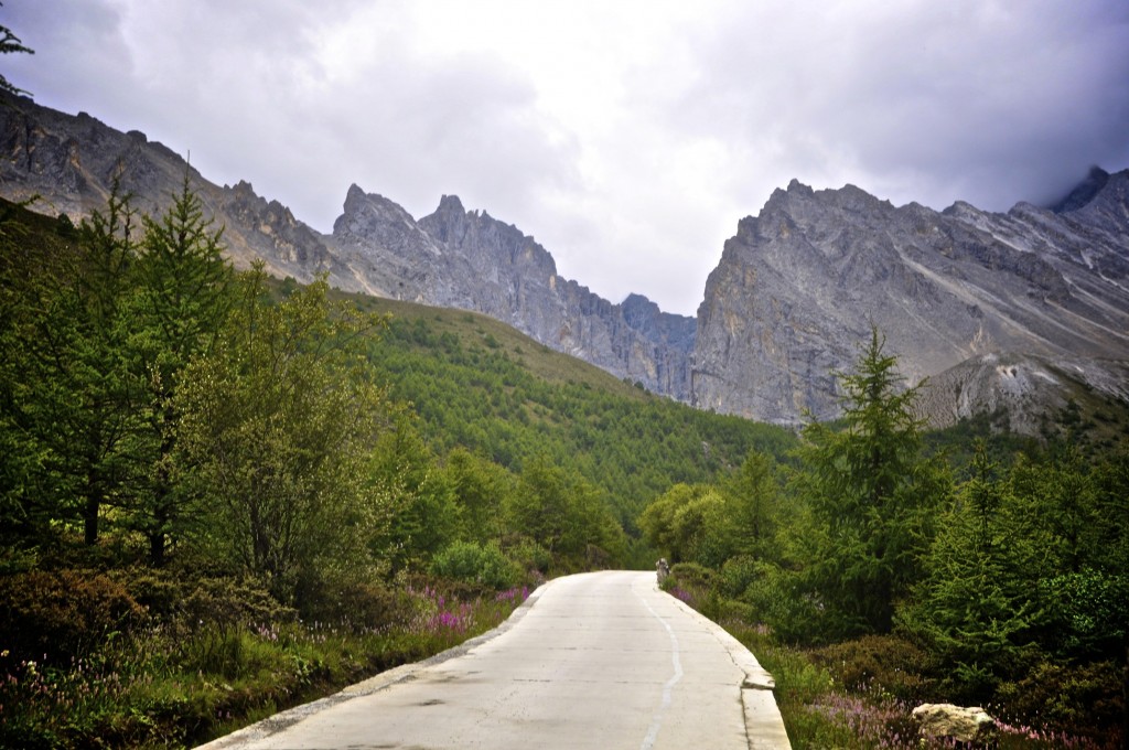
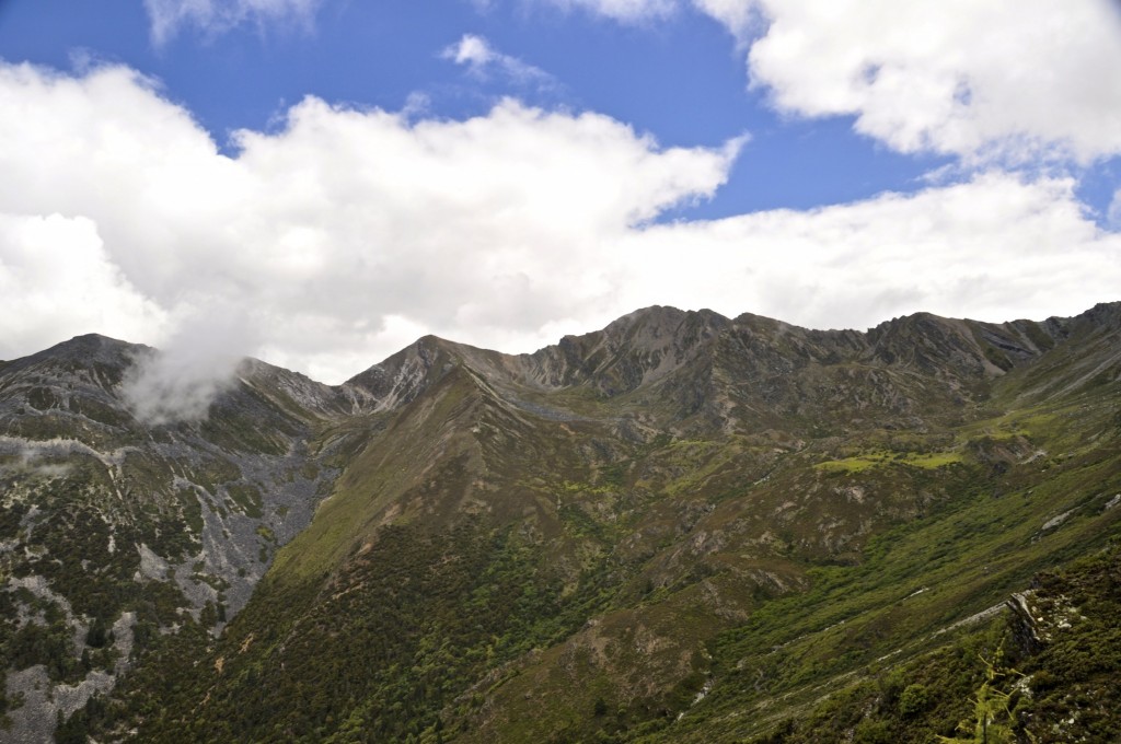
The Yading Nature Reserve is found in western Sichuan’s Garze Tibetan Autonomous Prefecture དཀར་མཛེས་བོད་རིགས་རང་སྐྱོང་ཁུལ་ in the traditional Tibetan region of Kham. Garze དཀར་མཛེས་, known in Chinese as Ganzi , is divided into 18 counties covering an area of 151,000 square kilometers (58,300 square miles). Yading is located in southern Daocheng county, which is known as Dapba འདབ་པ་ in Tibetan. The Yading Nature Reserve covers an area of 1344 square kilometers (520 square miles) and has an average elevation of well over 4000 meters.
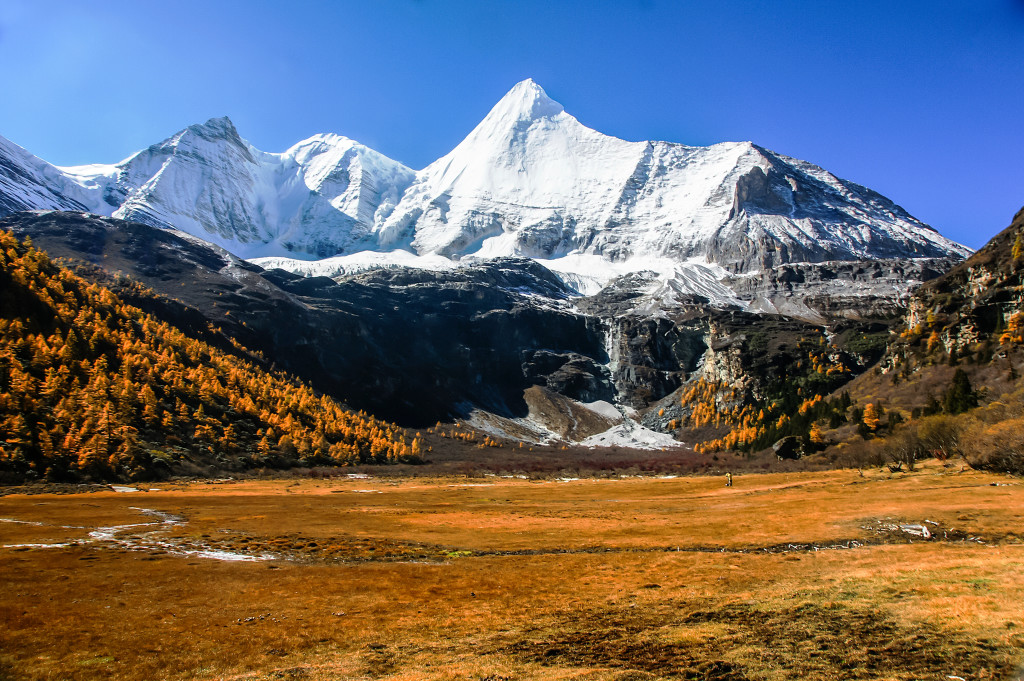
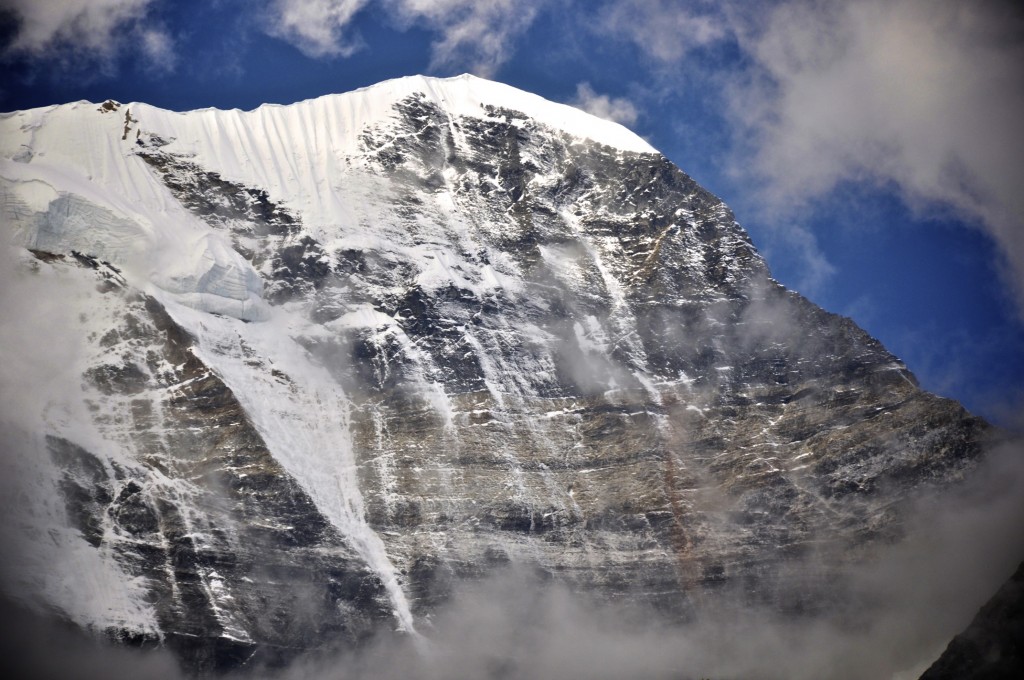
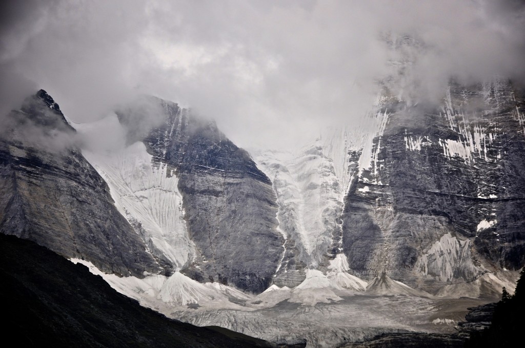
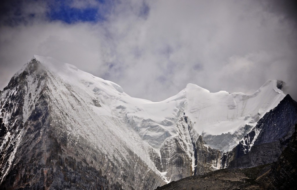
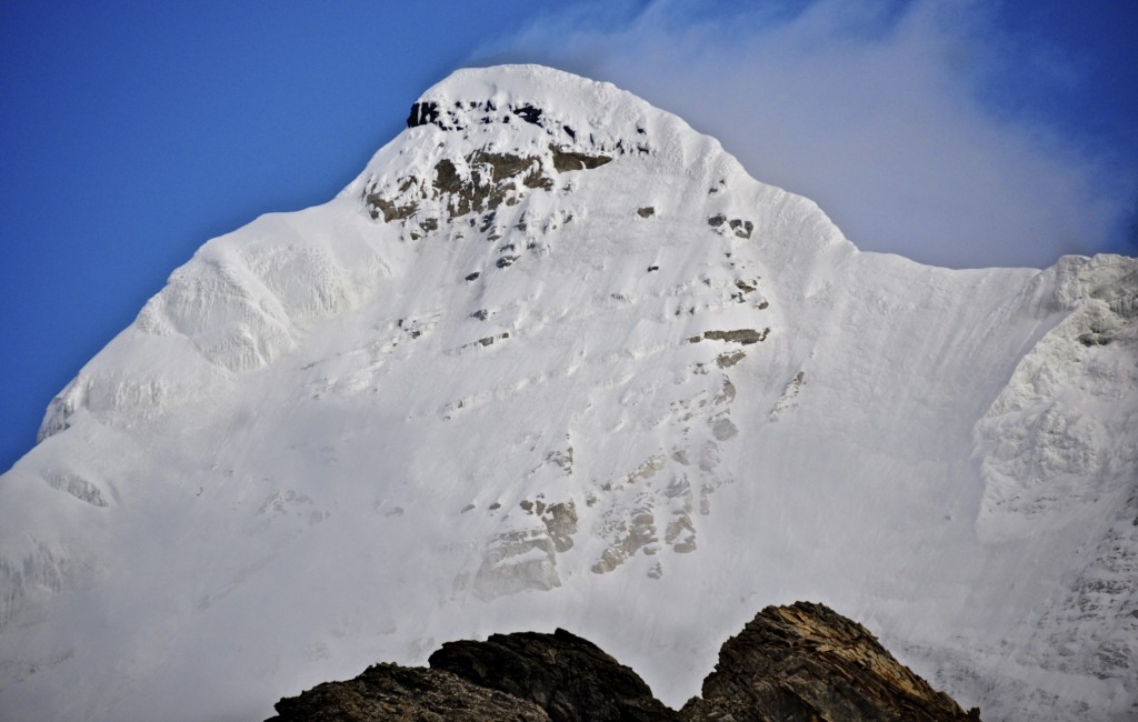
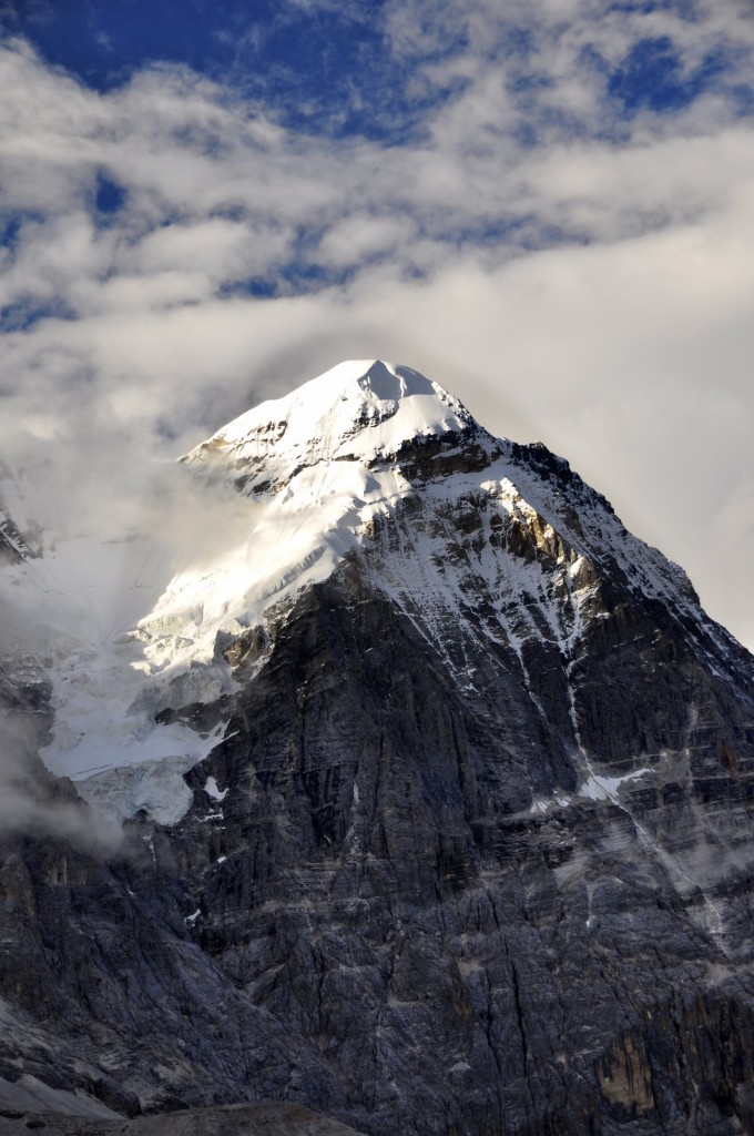
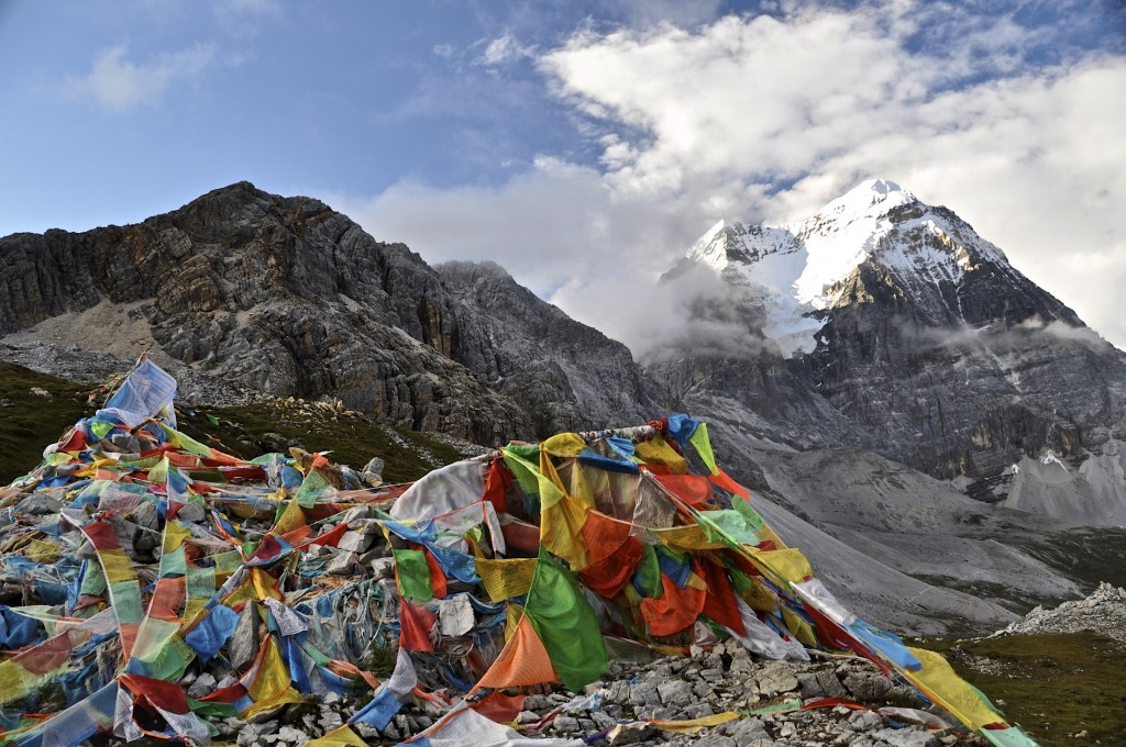
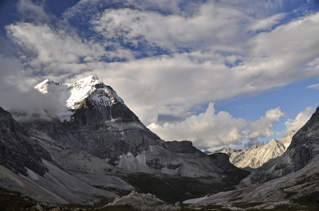
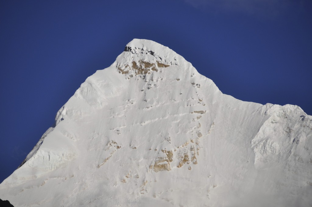
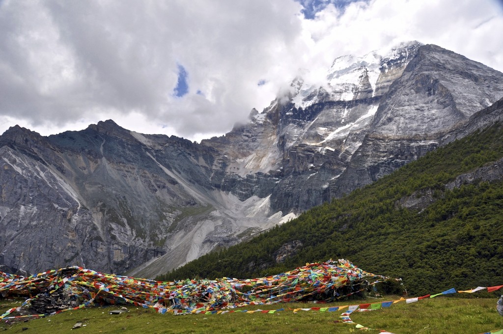
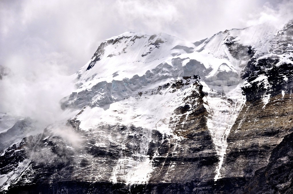
Inside the Yading Nature Reserve are the 3 holy mountains of Chenresig, rising to 6032 meters, Chana Dorje and Jampelyang, which both rise to 5958 meters. These 3 snow-capped peaks sit in a triangle formation with forested valleys, clear rivers, glacier-fed lakes and abundant wildlife between them. The Tibetan name for Yading is “Nyingden” ཉིང་རྟེན་, however, signs in the region regularly use the term “Aden”. The local Tibetan name for the area around the 3 holy mountains is “Rigsum Gonpo”. In Tibetan, the names of the mountains mean “Wisdom” (Jampelyang), “Power” (Chana Dorje) and “Compassion” (Chenresig). This region was designated as a nature reserve in the late 1990’s.
Joseph Rock and his Shangri La
The first westerner to see the area of Yading was the famous American botanist and explorer Dr. Joseph Rock. Dr. Rock explored the southeastern portion of the Tibetan Plateau (modern day western Sichuan and northwest Yunnan provinces) in detail for over 20 years beginning in the mid-1920’s. In 1928, he arrived in Yading and photographed the entire region. In the July 1931 issue of National Geographic, more than 60 pages are dedicated to the writings and photographs of Dr. Rocks travels in this area. This issue of National Geographic gave the world its first pictures of the incredible beauty of the Yading area.
Many regions of the Himalaya’s are referred to as “Shangri La”, the fictional paradise written about by James Hilton in his famous novel “Lost Horizon”, which was published in 1933. In 2001, the Tibetan county of Zhongdian (Gyelthang in Tibetan) in northwest Yunnan province was officially renamed “Shangri La” in an attempt to market more tourism to the area. Other regions in Nepal, India and Bhutan market themselves as being the “real Shangri La”. Most likely, James Hilton based his fictional place of Shangri La after the pictures that Joseph Rock published in the July 1931 issue of National Geographic. More recently, the small town of Riwa, located 35kms north of the entrance to the Yading Nature Reserve, also officially changed its name to “Shangri La”. Of all the places that call themselves “Shangri La”, the Yading Nature Reserve probably best represents what James Hilton was thinking about when he wrote “Lost Horizon”.
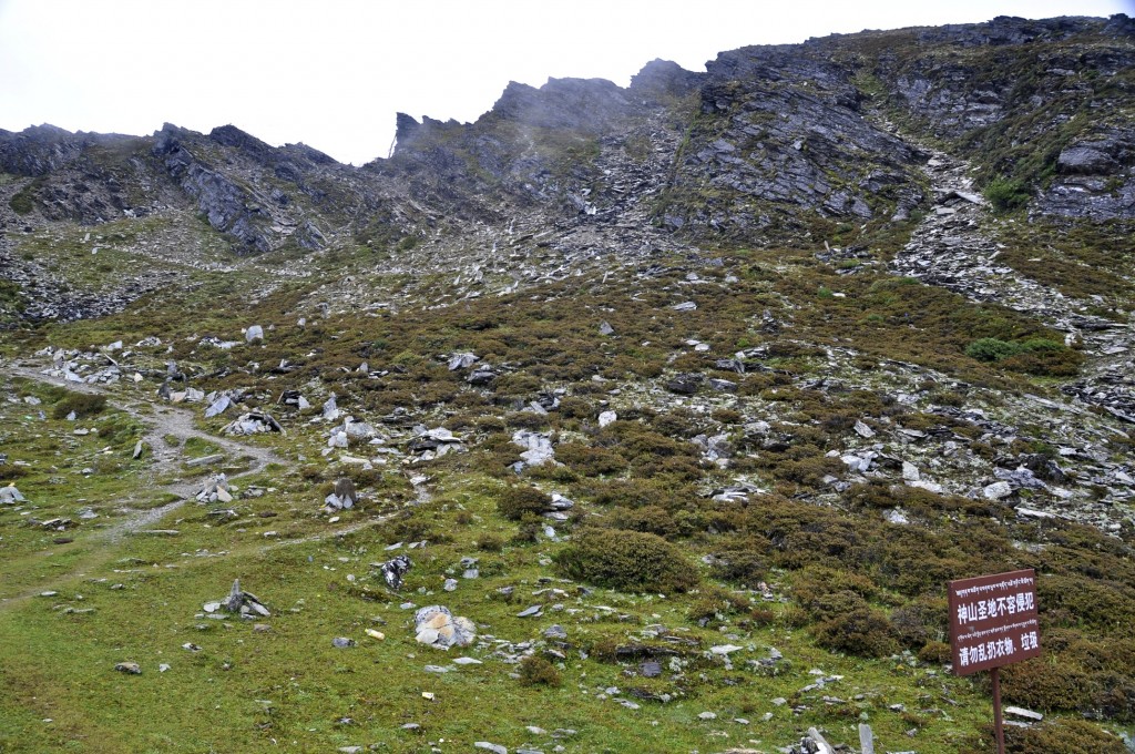
Though the outside world didn’t learn about Yading until 1931, local Tibetans have known about Yading for more than 800 years. Tibetans from the region have long considered the 3 peaks of Chenresig, Jampelyang and Chana Dorje to be the “abode of the gods”. Pilgrimage circuits go around the entire region as well as around each individual mountain. Local Tibetans try and complete a circuit around the highest mountain in the reserve, Chenresig, at least once a year.
Due to its remoteness, the Yading Nature Reserve is still relatively unknown to foreign travelers, but that is starting to change. It is just now getting listed in popular guidebooks for Tibet and China, such as the current 2015 Lonely Planet China guidebook. Yading is becoming extremely popular among Chinese tourists, as is evident by large tourist buses that are seen everyday during the summertime. Continue reading to learn how to reach Daocheng and the Yading nature Reserve.
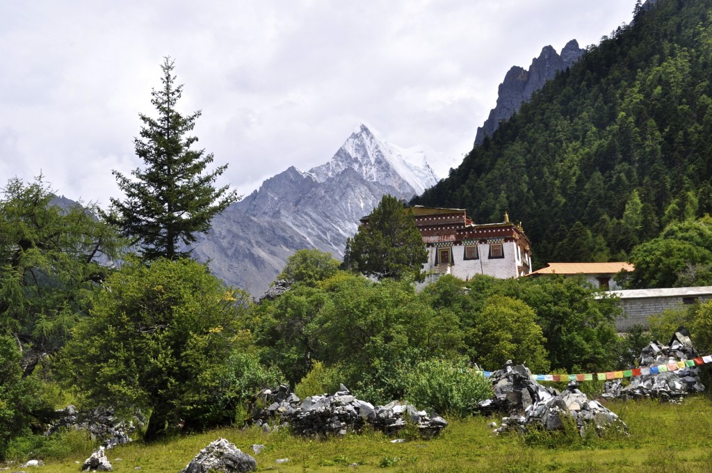
The view from Chong Gu Monastery
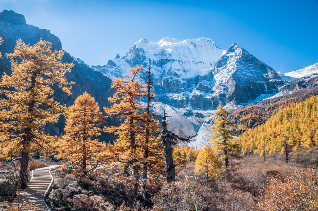
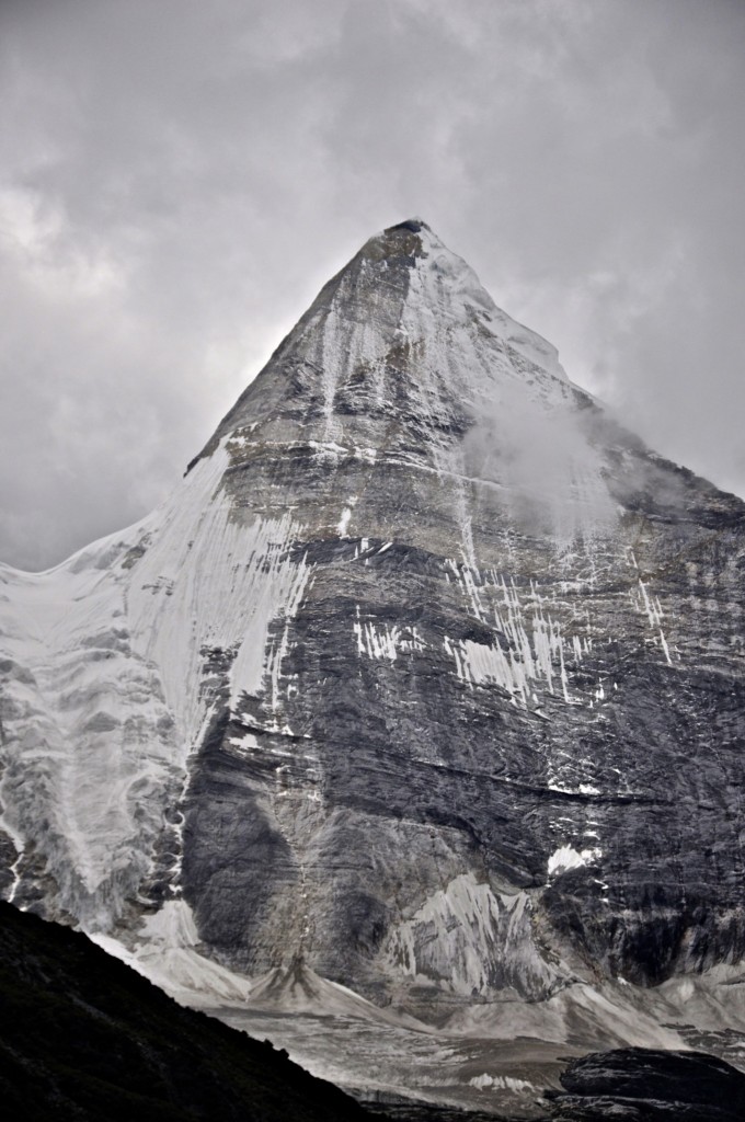
Mt. Jampelyang
Getting to Yading Nature Reserve
Yading Nature Reserve is now quite easy to reach since the airport was completed in 2013. Here are the 3 main ways to reach Yading:
By Bus
From the bus station in Chengdu, there is 1 daily us that goes directly to Daocheng, the county capital where Yading is located. This grueling bus ride takes 21 to 24 hours. Due to the high elevation of Yading at 4000 meters, and the extremely long bus ride from Chengdu, I HIGHLY recommend first going from Chengdu to Kangding (multiple buses per day taking between 9 and 12 hours) and stay there for 1 or 2 nights to acclimatize. In Kangding, I recommend staying at Zhilam Hostel, by far the best hostel in all of Kham. From Kangding, there are usually 2 buses per day going to Daocheng taking between 11 and 13 hours.
Keep in mind that the Yading Nature Reserve is located 110 kilometers south of Daocheng. From Daocheng, you can take a shared mini-van taxi to the small town of Riwa, which is now officially known as Shangri La/ Xiang Gel Li La (not to be confused by the town and county in Yunnan that has the same name). A seat in a shared mini-van taxi costs 50 RMB per person and the journey takes about 2 hours to cover the 75 kilometers. There are Tibetan mini-van drivers located along the main street in Daocheng. They will probably find you before you find them! In addition, your hotel or guesthouse can help arrange a seat for you to Riwa.
In Riwa, you have to buy your entrance ticket for the Yading Nature Reserve as it is not possible to drive beyond this point, except for local traffic. The ticket price is 150 RMB per person, but you also have to buy a 120 RMB roundtrip bus ticket for a total price of 270 RMB per person. The bus ticket is for the 35 kilometer journey from Riwa to Yading Village and on to Long Long Ba (the real main entrance to Yading).
By Flight
The Daocheng Airport opened in September 2013 and is the highest commercial airport in the world at 4411 meters/14,472 feet high. During the high season from May through mid October, there are at least 2 flights per day from Chengdu to Daocheng and some days have 3 flights per day. The flight takes 1 hour. During the low season, mid October through late April, there is just 1 flight per day to Daocheng. During the middle of winter, flights can be suspended due to weather and/or lack of bookings.
During the high season months, there are also 3 or 4 flights per week from both Chongqing and Kunming to Daocheng. Both of these flights take 1 hour. In the low season, mid October through late April, the flights from Chongqing and Kunming to Daocheng are suspended.
Flights to Daocheng can be purchased on both Elong Travel and C-Trip Travel.
The Daocheng Airport is located about 50 kilometers north of the Daocheng County town. The Airport Shuttle Bus costs 30 RMB per person and takes about 45 minutes and will drop you off in the center of Daocheng town. Follow the instructions above in the “By Bus” section to learn how to go from Daocheng to the park entrance of Yading.
By Private Vehicle
Some people prefer to visit Daocheng and Yading by using a private vehicle from Chengdu. The overland route from Chengdu to Shangri La in Yunnan (via Yading) is quite popular. A private vehicle with a driver allows you to really see this region up close while making as many stops along the way as you want. A private vehicle also lets you acclimatize better by gradually ascending. For information on taking a private vehicle through this region, feel free to email me at: thelandofsnows@gmail.com
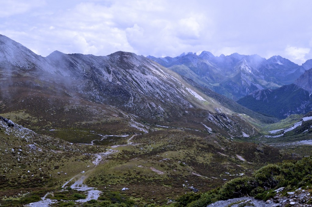
View from the first col along the 2 day trek around the main peak at Yading.
Where to stay in Yading
In Daocheng, more and more hotels are being built all the time. When I was last there (July 2016), there were at least 8 new hotels that were being constructed. Daocheng now has everything from basic youth hostels to 4 Star Hotels. For a basic, but clean and friendly guesthouse, I highly recommend the Hu Xin Guesthouse. For some reason, the prices listed on Booking.com are much higher than the rates quoted in person. I recommend calling the Hu Xin Guesthouse directly at (86)0836-572-7884 (limited English). Another friendly hostel is the Yading Backpackers Hostel. I stayed at Drolma’s Guesthouse, but found the staff to be VERY unfriendly. I don’t recommend staying at Drolma’s Guesthouse even though it is listed in all the major guidebooks for the region.
For a proper hotel in Daocheng, I highly recommend the Heaven Holiday Hotel (Lan Ka Jia Ri Jiu Dian 兰卡假日酒店). The prices quoted to me in person, 320 RMB w/breakfast, were cheaper than the prices I could find online, so try calling them at (86)0836-572-1333 (no English). Another good hotel in Daocheng is the Holy Land Yading Hotel (Sheng Di Ya Ding Jiu Dian 圣地亚丁酒店).
In Riwa (aka Shangri La town) there are now numerous nice hotels and guesthouses to stay at with more planned to be built. Remember, Riwa is the last town that you can reach using shared mini-vans. After Riwa, you have to use the park bus, which costs 120 RMB/person, to go the remaining 35 kilometers to Yading Village. The Tibetan Buddhism Cultural Theme Hotel is a decent choice with reasonable rates in Riwa. If you are looking for a bit of luxury in Riwa, I recommend the Holyland Hotel.
In Yading Village, there are several very basic Tibetan-style guesthouses to stay at that have clean rooms and serve basic Tibetan and Chinese dishes. There are no hotels or guesthouses beyond Yading Village.
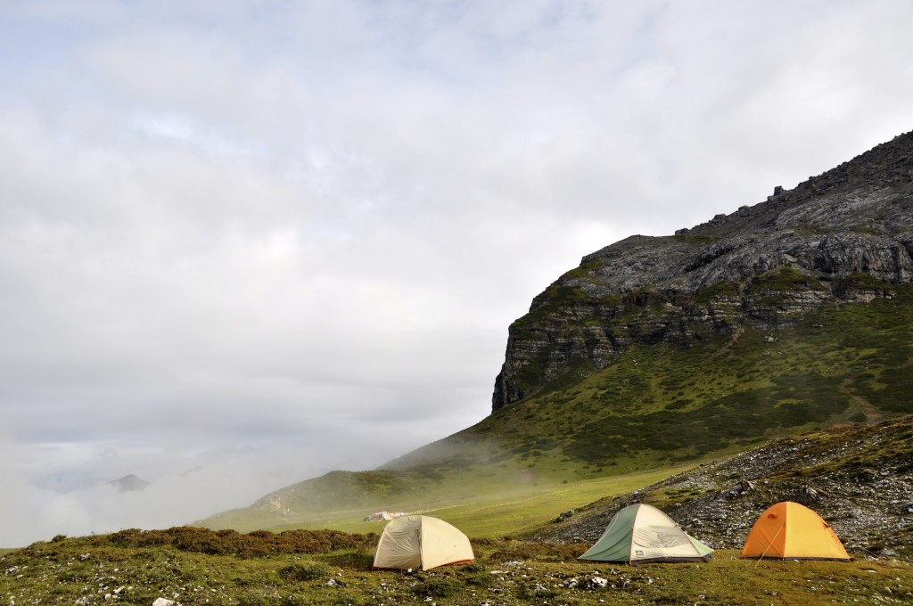
WHERE TO CAMP FOR TREKKERS: The only place to camp is past Milk Lake on the back side of the First Col. It is not possible to camp at Chong Gu Monastery, Luorong Grasslands, Milk Lake or anywhere else before the First Col. This means you will need to set up camp on the BACK side of Yading, quite far from the main entrance. Read further down this post for a detailed trekking guide as well as my recommendation on where to camp.
Getting around inside Yading Nature Reserve (not trekking)
From Long Long Ba to Chong Gu Monastery
The Yading Nature Reserve is full of stunning beauty and is an excellent place to do some trekking. If you don’t have time to trek or have no interest in trekking, Yading is still very much worth going to. The park bus can now take you past Long Long Ba (the real entrance to Yading) and to within a 10 minute walk of Chonggu Monastery. From the parking lot, you can walk the remaining short distance to Chonggu.
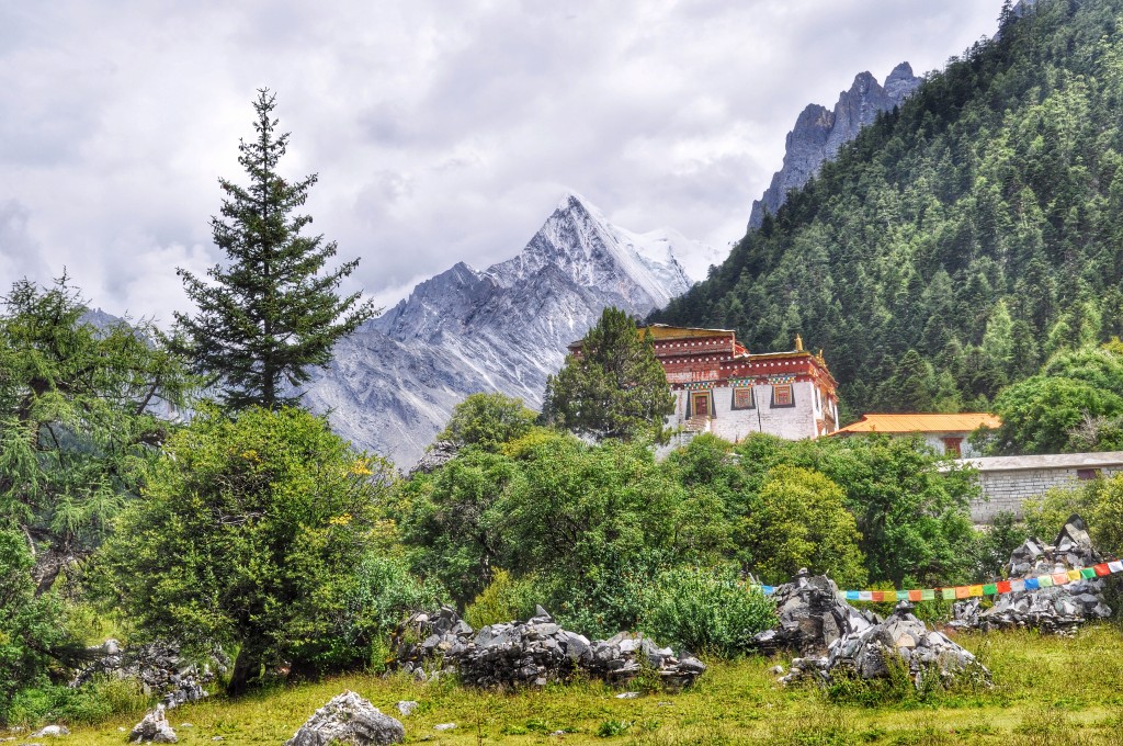
Chong Gu Monastery sits at 4000 meters. This small monastery is nearly 800 years old and sits at the base of Mt. Chenresig’s north face. Mt. Chenresig, known in Chinese as Xian Nai Ri, is the highest mountain in the reserve rising to 6032 meters. The views of Chenresig from Chong Gu Monastery on a clear day are superb. Some older information on the internet states that Chong Gu Monastery has a guesthouse. However, after asking some of the monks at the monastery, they said the guesthouse no longer exists. The nearest accommodation is back at Long Long Ba/Yading Village.
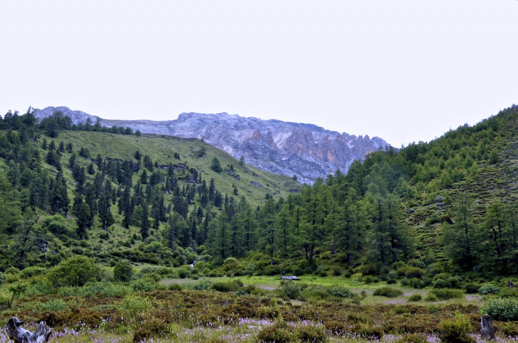
Luorong Grasslands
From Chong Gu Monastery to the Luorong Grasslands
From Chong Gu Monastery, the next main site is the Luorong Grasslands. About 100 meters past Chong Gu Monastery, there is a wood building on the left side where you can purchase tickets for an electric cart that can take you to Luorong. Tickets cost 50 RMB one way or 80 RMB roundtrip. The route between Chong Gu and Luorong is on a paved road that goes through a forested area following Mt. Chenresig’s east face before arriving at the wide open Luorong Grasslands. The distance between Chong Gu Monastery and Luorong Grasslands is about 6 kilometers (4 miles) and takes about 20 minutes in the electric cart or about 1½ to 2 hours to walk.
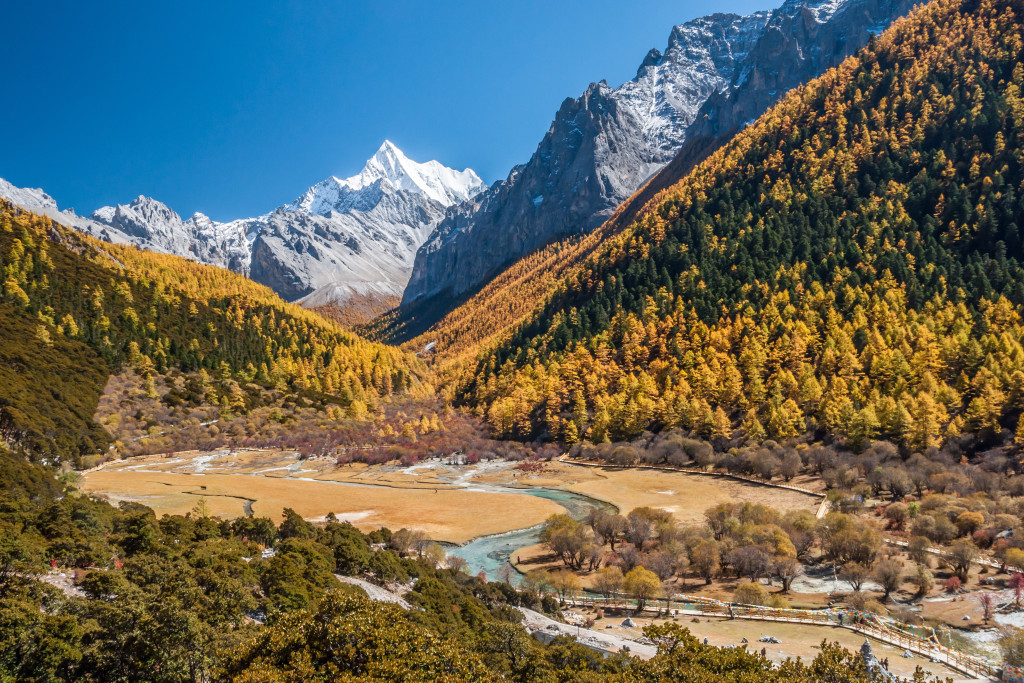
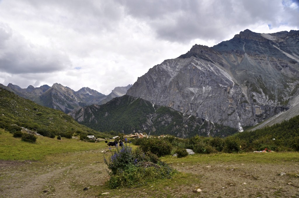
The Luorong Grasslands lie at an elevation of 4180 meters and offer an amazing view of all 3 holy mountains. On the right side is Mt. Chenresig’s southeastern face. On the left side is Mt. Chana Dorje’s (known as Xia Nuo Duo Ji in Chinese) northeastern face while Mt. Jampelyang’s (Yang Mai Yong in Chinese) north face dominates the front view from the grasslands. Luorong is one of the most scenic spots in Yading.
In addition to the paved road that leads to Luorong, there are also some wooden walkways and bridges that are built on the grasslands to the right of the road. Walking directly on the grasslands is not allowed. Towards the middle of the Luorong Grasslands there are some permanent huts where local Tibetan herders live during the late spring and summer months. Older information on the internet suggests that you can either camp at Luorong or stay in one of the nomads huts, however the leader of the Luorong Grasslands informed me that neither was possible any longer. Camping at Luorong is strictly forbidden and the local Tibetans are not allowed to host guests.
Yading Nature Reserve in the Kham region of Sichuan
From Luorong Grasslands to Milk Lake and 5 Color Lake
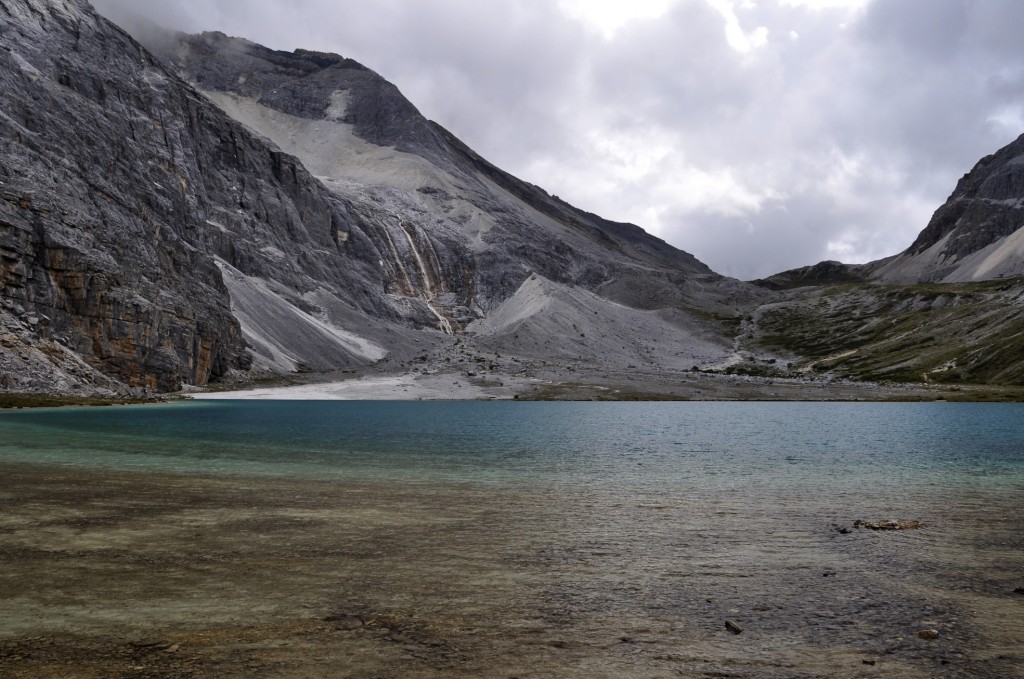
Nearly all Chinese tourists will take the electric cart to Luorong. Very few, if any, will hike in. After Luorong, the pilgrimage path around Mt. Chenresig gets more difficult and rough. The Tibetan nomads who live at Luorong rent horses and an animal tender to take people to Milk Lake, the next main attraction along the pilgrimage route of Mt. Chenresig. The distance from Luorong to Milk Lake, known as Niu Nai Hai in Chinese and O Tso in Tibetan, is about 5 kilometers (3 miles) and takes about 1 1/2 to 2 hours on horseback each way or about 2½ to 3 hours to walk. Milk Lake sits at an elevation of 4480 meters. The cost of renting a horse from Luorong to Milk Lake is around 300 RMB to 400 RMB per person for the roundtrip.
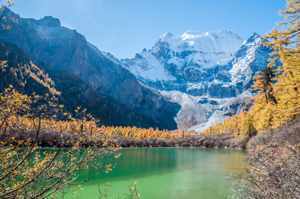
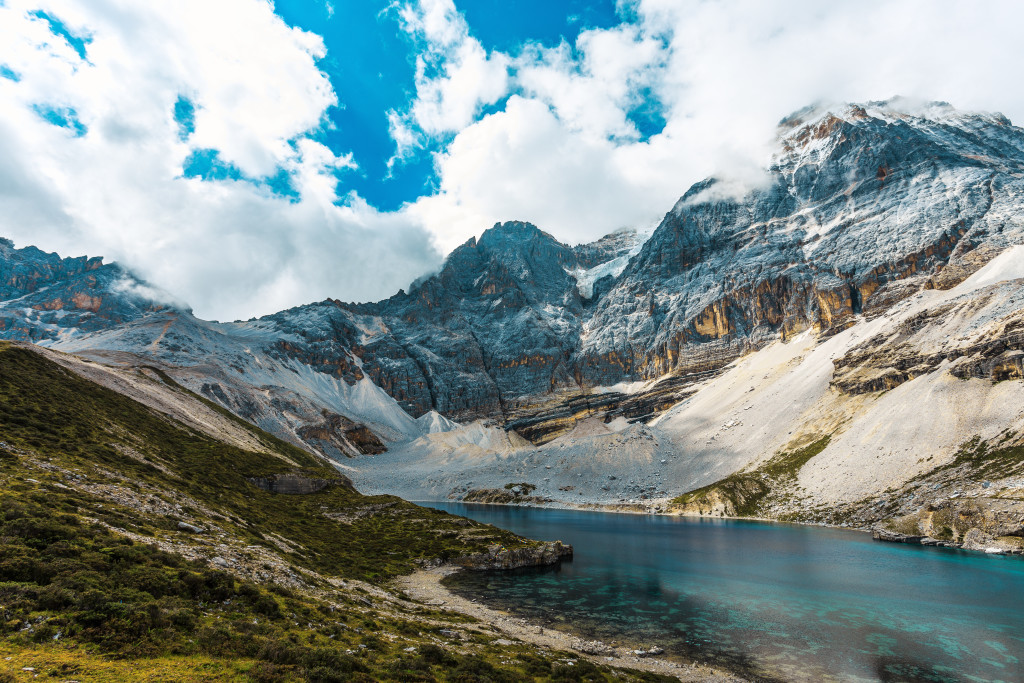
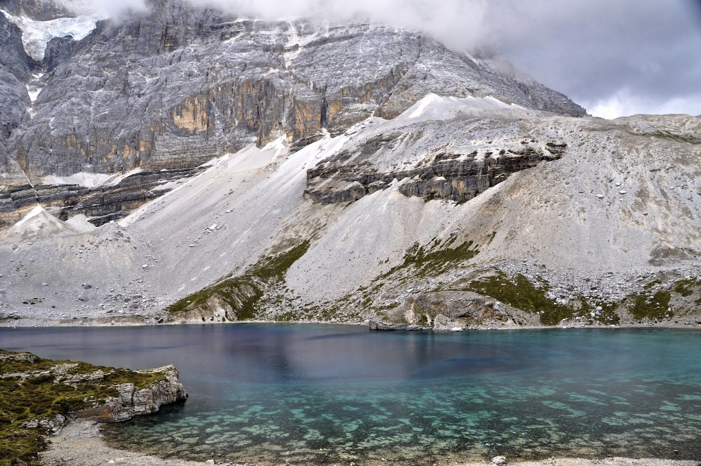
Milk Lake is a stunning glacier fed lake on the south end of Mt. Chenresig. Above Milk Lake is another lake named 5 Color Lake, known as Wu Se Hai in Chinese. This lake sits at 4530 meters and takes about 20 minutes to reach from Milk Lake. The hired horses usually do not do the climb up to 5 Color Lake so you will probably have to hike this short portion. Sitting right at the base of the south face of Chenresig, 5 Color Lake is the most beautiful lake around the pilgrimage circuit and should be visited. NOTE: Horses can not be rented to go to 5 Color Lake. You must hike to reach 5 Color Lake.
The local Tibetans told me that camping at Milk Lake and 5 Color Lake is not allowed. The closest place to camp would be below the high pass that is about 215 vertical meters above Milk Lake.
Milk Lake is as far as you can go without having to trek. Past Milk Lake there are no more horses to be rented. Those not trekking would have to turn around and take their horse back to Luorong Grasslands and then take the electric cart back to Chong Gu Monastery before going back to the trailhead at Long Long Ba and back to Yading Village.
Milk Lake
Trekking Yading: Mt. Chenresig
The most popular pilgrimage circuit (kora) in Yading is around the highest mountain, Chenresig. It is possible to do this trek in one long 12 to 14 hour day, but taking 2 days to complete the kora is a better option as it gives you more time to really enjoy the area.
Trekkers will need to arrive at Yading with tents, sleeping bags, food and water. Kangding is the best place in the region to purchase trekking gear and food. The town of Daocheng has some small grocery stores, but selections are limited. There are rivers along most of the trek so bringing a water purifier or boiling water is an option. Since nearly all of this trek is above 4000 meters, cold weather clothing is required, even in the summer.
The best time to do this trek is from late-April to mid June and then from early September to late October. The summer months from mid June to early September are possible, but rain and clouds can severely limit visibility. It is rare to get clear views of the summits of the 3 mountains during those months (but not impossible). The winter months from early November through early April can bring extreme cold temperatures and possible heavy snow, so trekking then is not recommended unless you are very experienced.
A guide is not required for the 2 day trek around Chenresig, though if you want one, a guide can be found at the trailhead at Long Long Ba. They charge around 300 to 400 RMB per day. If you plan on doing a longer hike in the region, such as around all 3 mountains or to Lugu Lake, it is highly recommended that you take a guide with you. This trek is not recommended for those who have had problems with high elevation in the past. The highest point along the trek is 4700 meters and there are no medical facilities in the area.
Like nearly all treks in Tibet and China, there is no detailed trekking map of the region. You can go here to find a crude drawing of the 2 day trek around Yading: ChinaTrekking.com Map
NOTE: When trekking, you will need to set up your camp BEYOND THE FIRST COL. You cannot set up camp anywhere before this point. Due to the elevation, I recommend setting up camp at the so-called “First Hut”, described in Stage 5 below.
The highest pass on the trek
Stage 1: Long Long Ba to Chong Gu Monastery
- Elevation Gain: +230 meters
- Distance: 3 to 3 1/2 kilometers (2 miles)
- Time: 45 minutes to 1 hour
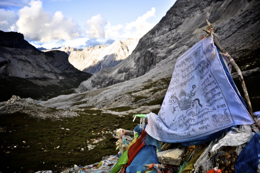
Long Long Ba is the start of the trail around Mt. Chenresig. NOTE: Long Long Ba is just a short few minute walk from Yading Village. The elevation here is 3770 meters. The path to Chong Gu Monastery is wide and easy to navigate. It goes through a forested area with a river flowing on the right hand side. There are several high stacks of carved prayer stones along the way.
From Long Long Ba to Chong Gu Monastery takes between 45 minutes and 1 hour to hike. The distance is around 3 to 3 1/2 kilometers (2 miles). The elevation gain is around 230 meters.

Chong Gu Monastery

River flowing through Yading Nature Reserve in Dabpa county
Stage 2: Chong Gu Monastery to Luorong Grasslands
- Elevation Gain: +180 meters
- Distance: 6 kilometers (3.75 miles)
- Time: 1 1/2 to 2 hours
As stated at the top of this post, it is now possible to take the park bus to within 10 minutes walk of Chonggu Monastery, so some of you may choose to start from there. Chong Gu Monastery lies along the north face of Mt. Chenresig at an elevation of 4000 meters. A clear, glacier-fed river flows through an evergreen forest making this spot one of the most scenic along the trek. The views of Chenresig’s north face from here are spectacular.
The monastery lies off of the main path on the right side. The trail to the monastery is easy to find. The monastery lies less than 5 minutes off of the main path. On the left side, there are more than a dozen toilets to use. There is also a nice sheltered area with lots of benches to rest on. Using a water purifier (or boiling), you can refill your water bottles from the river that flows below the monastery.
The monastery is quite small and has just a handful of monks. When I was there, no entrance fee was charged, though some places on the internet say that a 10 RMB ticket is required. There used to be a guesthouse next to the monastery, but now there are no accommodations or restaurant. Camping at Chong Gu Monastery is not permitted.
From Chong Gu Monastery to Luorong Monastery the path is a paved road. This is the only section of the trek that goes along a paved road. This is not a public road, but a private road where electric carts take Chinese tourists between the two places. Chinese tourists rarely hike and prefer to take the electric cart, which takes about 20 minutes. The road goes through a beautiful forested region following the eastern face of Mt. Chenresig.
The road gains a total elevation of 180 meters before arriving at Luorong. The distance is about 6 kilometers (3.75 miles) and takes 1 1/2 to 2 hours to complete.
North face of Chenresig
Paved walkway from Chong Gu Monastery to Luorong Grasslands
Mt. Jampelyang
Stage 3: Luorong Grasslands to Milk Lake
- Elevation Gain: +300 meters
- Distance: 4 1/2 to 5 kilometers (3 miles)
- Time: 2 1/2 to 3 hours
The Luorong Grasslands, elevation 4180 meters, offer an amazing view of all 3 mountains. Mt. Chana Dorje, rising to 5958 meters, will be on your left side, the southeast face of Chenresig will be on your right side and Mt. Jampelyang’s north face, also 5958 meters, will be in front of you. Dr. Joseph Rock published a fantastic photo of Mt. Jampelyang in the July 1931 issue of National Geographic. He took the photo from the Luorong Grasslands. The glaciers of Mt. Jampelyang are especially beautiful.
As you get closer to Luorong, a wooden walkway goes from the road to the grasslands off on the right side. Both the road and the wooden walkway lead to the same place. Walking directly on the grasslands is not allowed.
The Luorong Grasslands are quite large and are a brilliant green color during the mid-summer. There are a high bundle of Tibetan prayer flags in the middle of the grasslands. There are wood benches around these prayer flags where you can take a rest. On the far end of the grasslands are 8 to 10 small huts where local Tibetans live during the spring and summer months. These Tibetans rent horses to Chinese tourists who wish to go to Milk Lake. Camping at the Luorong Grasslands is not permitted and the Tibetans are not allowed to host guests.
From Luorong, you will follow the wooden walkways toward the group of huts occupied by local Tibetans. Past these huts, you will go towards the left where the path returns to dirt. You will follow this dirt path along the rest of the grasslands that lie in front of Mt. Jampelyang. Leaving the grasslands, the path gently turns around the southeast part of Mt. Chenresig.
Keep in mind that you are following the route around Mt. Chenresig and not Mt. Jampelyang. Always keep Chenresig on your right hand side. The path goes up a steep pass that is covered in Tibetan prayer flags. As you reach the top of the pass, the north face of Mt. Jampelyang goes out of view. The path is well marked and you will probably see Chinese tourists on horseback. If you ever have any questions, ask any of the friendly Tibetans you see along the way. Local Tibetans say that camping along the lake shore is not allowed and that you need to descend down below the First Col to camp.
After the pass, there is a slight descent and Milk Lake can be seen in the distance. The path remains well marked. The route from Luorong Grasslands to Milk Lake gains about 300 meters in elevation and covers a distance of 4 1/2 to 5 kilometers (3 miles). It takes between 2 1/2 to 3 hours to trek this stage.

Luorong Grasslands
North Face of Jampelyang
Snow-capped Mt. Jamelyang
Milk Lake
Stage 4: Milk Lake to the First Col (Pass)
- Elevation Gain: +220 to +250 meters
- Distance: 1 1/2 kilometers (1 mile)
- Time: 45 minutes to 1 hour
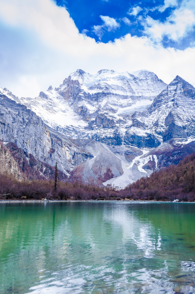
Milk Lake, elevation 4480 meters, is a stunning glacier-fed lake that sits at between Mt. Chenresig and Mt. Jampelyang. This lake is considered holy to the Tibetan people so swimming in the lake is not allowed. Milk Lake, known as Niu Nai Hai in Chinese and O Tso in Tibetan, is very picturesque. The lake is crystal clear and the reflection of Mt. Jampelyang mirrors off the lakes surface.
A short 20 minute hike above Milk Lake is 5 Color Lake, which sits at 4530 meters in elevation. This lake sits right at the base of the south face of Mt. Chenresig. The trail leading up to 5 Color Lake is well defined and easy to find. There are piles of prayer stones around the lake that are draped in prayer flags. Five Color Lake is the most beautiful of all the lakes around Chenresig.
From Milk Lake, the trail continues north of the lake (right side) and leads up to a col (pass) between 2 mountains. From the shores of Milk Lake, you can clearly see the route that the path follows. From the lake the ascent looks easy, but the top of the col gains about 220 meters. By this point of the trek, most people are feeling quite tired which makes climbing this portion difficult. The trail is a little rocky in spots, but overall is not bad.
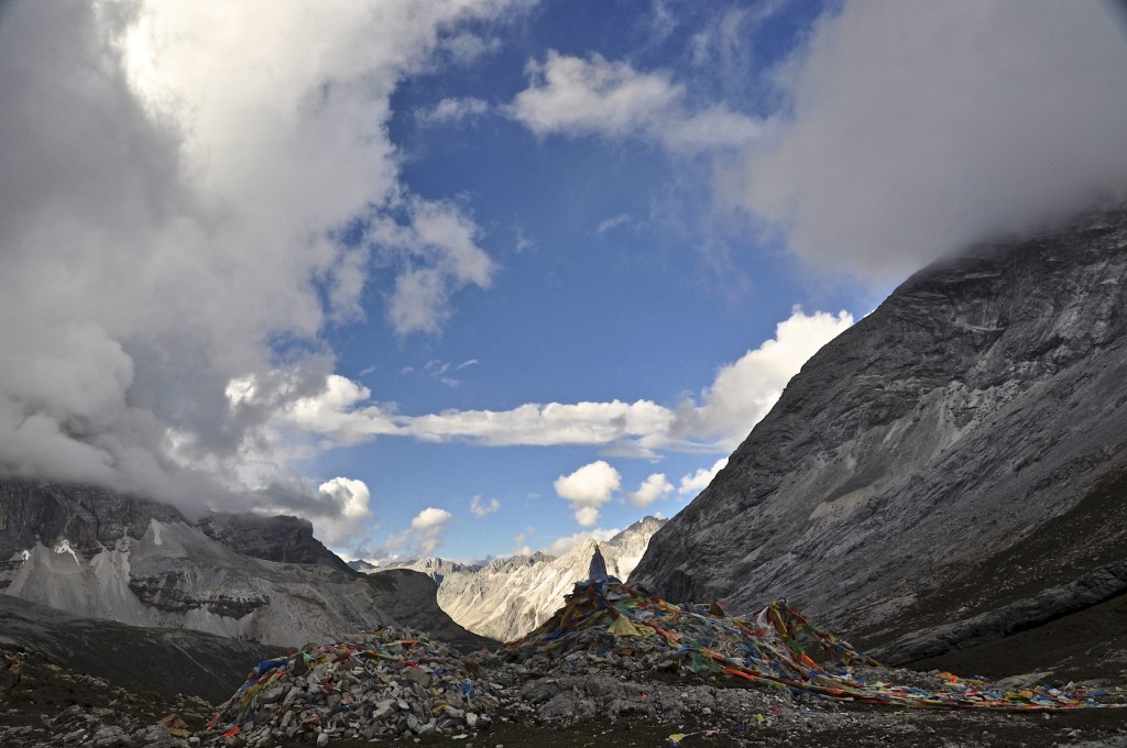
At the top of the pass there are piles of prayer stones and a large amount of prayer flags. The top offers an amazing view of the southwest face of Mt. Chenresig as well as a great view of Mt. Jampelyang. The elevation of the pass is 4700 meters, roughly 220 to 250 meters above Milk Lake. The distance from Milk Lake to the top of the col is 1 1/2 kilometers (1 mile) and takes 45 minutes to an hour to climb.
Mt. Chana Dorje
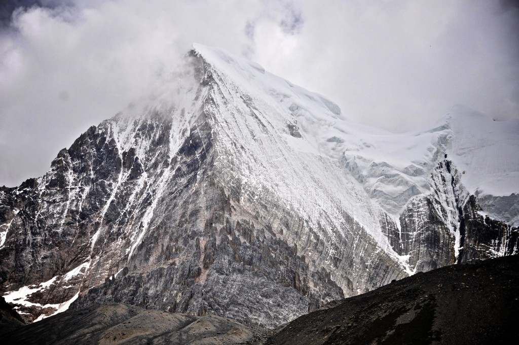
Distant view of Mt. Chenresig
5 Color Lake
Top of the 1st Col
Stage 5: First Col to the First Hut
- Elevation Loss: -220 meters
- Distance: 2 1/2 kilometers (1 1/2 miles)
- Time: 45 minutes to 1 hour
From the top of the pass where the prayer flags are, continue going straight for a short distance. Around 150 or 200 meters past the prayer flags, you will reach a fork in the path. Near this fork, there is a prayer wheel on a wooden pole. At the fork in the road, it is IMPORTANT to turn right (north) and keep Chenresig on your right side. If you continue going straight, you will go off of the the correct path and could become lost. From the turn, you will hike towards the north. Another small group of prayer flags will appear after about 400 meters. These prayer flags stand on top of another pass. From this pass you can see the valley below.
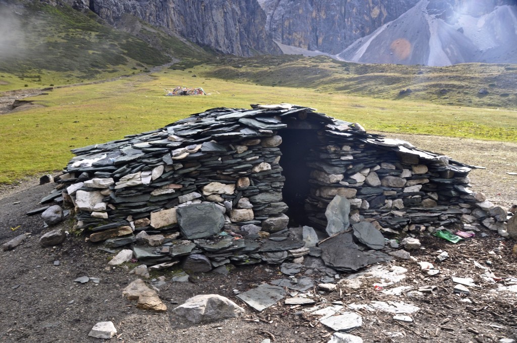
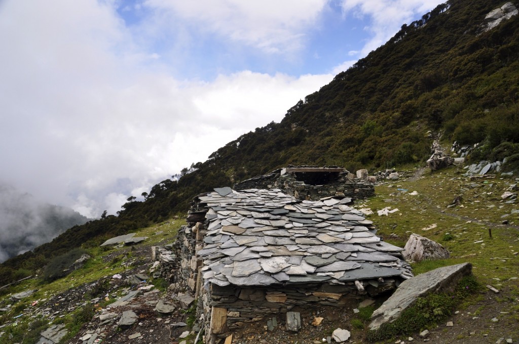
The descent from the First Col is quite easy. The trail is rocky in places, but overall is not difficult. After a short while, you will see another alpine lake on your left side. The path continues below Mt. Chenresig on the right side of the lake. After 45 minutes to 1 hour, you will come to an abandoned rock hut, nicknamed the “First Hut”. This First Hut is on a flat grassland area that is perfect for setting up camp for the night. I recommend camping here for the night as after the First Hut the trail begins to ascend again to another high pass. There is a nearby stream where you can refill your water supply.
From the top of the First Col to the First Hut is about 2 kilometers (1 1/4 miles). The elevation of the grassland area where the First Hut is located is 4480 meters.
View from the 1st Col
The path after crossing the 1st Col
Mt. Jampelyang
Stage 6: First Hut to Several Huts
- Elevation Loss: -150 meters
- Distance: 2 1/4 kilometers (1 1/2 miles)
- Time: 40 minutes to 1 hour
From the first stone hut, you will continue descending the well marked path that lies about 30 meters to the right of the hut. Between the first stone hut and the group of stone huts, the trail gently ascends and descends, but overall drops in elevation around 150 meters. This stage of the trail is quite easy and goes by quickly.
Before reaching the group of stone huts, there is a good-sized river that flows across the train (very easy to cross without getting wet) where you can replenish your water supply. There is little or no water during Stages 7 and 8, so make sure you leave here with plenty of water. As a rule of thumb, it is wise to restock your water supply every time you come across a clean river. I personally use a SteriPEN and find that it works excellent with the rivers on the Tibetan Plateau. From this river, which is marked in prayer flags and piles of stones, it is just a short hike to the group of stone huts.
The “several huts” I am referring to is a group of 6 or 7 abandoned stone huts that are similar to the single hut mentioned in Stage 5. They are not on a grassland area, but are on a narrow ledge along the side of the mountain. For those hiking to the Kasi Hell Gulley (having a guide for that trek is highly recommended), there is an entrance to that trail from the group of stone huts.
The elevation of the group of stone huts is approximately 4340 meters. It takes between 40 minutes and 1 hour to reach the huts from the single hut mentioned in Stage 5.
The first stone hut
Camping at the first hut
Group of stone huts
Stage 7: Several Huts to Second Col (Pass)
- Elevation Gain: +320 to +350 meters
- Distance: 3 kilometers (2 miles)
- Time: 2 to 2 1/2 hours
From the group of several huts, the climb up to the Second Col (Pass) is quite difficult and demanding. It is the most difficult stage of the trek in my opinion. The trail remains well defined and easy to see, but almost immediately begins to ascend from the group of huts. About 3/4 of a kilometer past the huts, the trail turns to the right. There is only 1 trail here so you can’t miss this turn. For those unfamiliar with the trail, you might think that this incline is the Second Col (Pass). It isn’t! Once you reach the turn in the trail, you will see that the Second Col is still far in the distance (over 2 kilometers away) and that you are still nearly 250 meters below the col.
The trail through this section is quite rocky, but isn’t difficult to navigate. This portion of the trail goes along Mt. Chenresig’s northwest face. Thousands of Tibetan prayer flags mark the top of the Second Col. The wind is normally quite strong and cold here. The top of the Second Col is around 4665 meters. It takes between 2 and 2 1/2 hours to trek the 3 kilometers (2 miles) from the group of huts to the Second Col.
Looking over to the 2nd Col in the distance
Looking up to the 2nd Col
Looking out from the top of the 2nd Col
Stage 8: 2nd Col to Prayer Flags at Chenresig’s North Face
- Elevation Loss: -250 meters to -275 meters
- Distance: 1 3/4 kilometers (1 mile)
- Time: 45 minutes to 1 hour
After crossing the Second Col at 4665 meters, it is all downhill the rest of the way. The trail is clearly visible and follows along Mt. Chenresig’s impressive north face. After hiking for about 45 minutes to 1 hour, you will come across a grassland area that is filled with Tibetan prayer flags. There are some more stone huts here and probably some grazing yaks. This point offers one of the best views of Mt. Chenresig as you are now directly below the north face of the mountain.
The grasslands where these prayer flags are sit at an elevation of 4400 meters. The distance from the Second Col to these prayer flags is about 1 3/4 kilometers (1 mile).
Prayer flags beneath north face of Chenresig
Mt. Chenresig in the Yading Nature Reserve
Stage 9: Prayer Flags along Chenresig’s North Face to Pearl Lake
- Elevation Loss: -250 meters to -275 meters
- Distance: 1 1/2 kilometers (1 mile)
- Time: 30 minutes to 45 minutes
From the prayer flags, the trail continues along the north face of Mt. Chenresig. The trail then goes through a forest of huge evergreen trees. After 30 to 45 minutes, you will reach Pearl Lake, known as Zhen Zhu Hai in Chinese. From the lakeshore, there is a great view of the north side of Mt. Chenresig. The elevation of Pearl Lake is 4140 meters. The distance from the prayer flags to Pearl Lake is 1 1/2 kilometers (1 mile).
Along the descent to Pearl Lake
Stage 10: Pearl Lake to Long Long Ba
- Elevation Loss: -370 meters
- Distance: 3 3/4 kilometers (2 1/3 miles)
- Time: 1 hour to 1 1/4 hours
The final stage of the trek takes you from Pearl Lake, elevation 4140 meters, to Chong Gu Monastery and then back to the park entrance at Long Long Ba. From Pearl Lake, the path becomes a wooden bridge that goes along Pearl Lake. After the lake, the path becomes wooden steps and wooden logs all the way to Chong Gu Monastery. After the monastery, the path is a wide, dirt road where Chinese tourists will be on horseback. The distance is about 3 3/4 kilometers (2 1/3 miles) and takes between 1 hour and 1 1/4 hours to complete. The elevation at Long Long Ba is 3770 meters.
Back at Chong Gu Monastery
The elevations I have listed are from using an altimeter and from using the latest edition of Google Earth. Distances were also determined from using Google Earth. These elevations and distances could be slightly off, but not by very much. The entire pilgrimage route around Mt. Chenresig is between 30 and 32 kilometers (18 1/2 to 20 miles). You will not get lost along this trek as long as you remember that you are circling Mt. Chenresig. Always keep Chenresig on your right side.
If you have any questions about this excellent trek or need a recommendation for a guide for the short 2 day trek or the longer 8 day trek, feel free to email me at thelandofsnows@gmail.com
Lobsang བློ་བཟང་
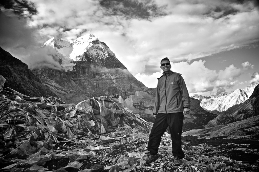
Me at the top of the 1st Col
Pingback: Overland from Chengdu to Shangri La « The Land of Snows
Pingback: Маршруты по Китаю Гонконгу Макао Тайваню • Re: Daocheng Yading Natural Reserve — кто был? Дорога, треккинг и советы по маршруту. | Дизайнерский клуб
Great nature and great remoteness. Thats what i am looking for in a trekking. I would like tot travel to yadin/yunnan in sept oct 2014.
Does anyone have experiece with an organisation calles whistling arrow? They do trekkings in that area but I would like to know whether it is a good organisation. Website loooks great though.
Txs, Regina van Hoof in The Netherlands
This was an amazing experience, Jamin, and trip! Stunning photos! Highly recommend taking this trek!
Can I camp at the Pearl Lake? Or will I have to move on to the grass land with Tibetan prayers flags? Thank you!
You probably will not be permitted to camp at Pearl Lake. You can try, but you probably will not be allowed to.
Lobsang
Pingback: Why You Should Visit Yading Nature Reserve – The Last Paradise on Earth | Julia The Resfeber
Thanks for the great write up and beautiful photos. Have always wanted to make this trip, may have the chance to go sometime this Fall.
Hello Lobsang,
Is it possible to enter the park with a bicycle? I am thinking about including this as a part of a bicycle trip.
Thanks!
Yiannis
Not sure….I suppose it might be possible. It will be up to the main gate people whether they will allow bicycles or not.
Lobsang
I see, thanks for your reply.
Pingback: Yading Nature Reserve – das echte Shangri-La | Windpferd und Fischsauce
Pingback: mount gongga - www.hardwarezone.com.sg
hi Lobsang,
Just wondering, after take some trekking in Yading Nature Reserve, i plan to go to Kangding or Litang. Is there any bus back from Daocheng to Kangding or Litang ?
Thanks 😀
Nice writing, really enjoy it.
Hello, I recommend downloading the Sichuan chapter of the current Lonely Planet China guidebook, which lists bus schedules and times between towns in the Kham region. There is one daily bus from Daocheng to Chengdu that makes stops in both Litang and Kangding.
Enjoy your journey!
Lobsang
There’s a bus from daocheng to chengdu. You should buy a ticket to Litang.
But be careful because the bus is usually fully booked. Ask un the hostel un daocheng how to buy the tickets un avance.
Hi Loshang Jamin,
Can you recommend any good travel guide book to show or describe the better detail about Yading Nature Park in Sichuan?
I like to explore this area in more greater depth and detail because I love to trek for at least 25 to 30 days in my visit to Sichuan in 2016.
Any good tips will greatly appreciated.
Thanks
Firstly, thank you for the awesome article. I am heading to Yading in a couple of weeks and this was perfect. 1 question, you said its probably not permissible to camp at Pearl lake, how did you discover where camping is permitted? I am looking to spend 3-4 days camping around Yading and want to make sure I stay within the rules but not sure where to confirm allowed camping area’s.
Thanks
Peter…I sent an email to you with further information. If you read carefully through the trekking details in this Yading post of mine, it will tell you specifically where you should camp. If you have other questions, please let me know.
Lobsang
Hi Lobsang, thank you for the detailed and wonderfull article about yading. It has been a great help!I am looking forward to see all these wonderfull places. We leave for china whithin one week and are also planning to do trekking and go camping in Yading but Its not clear for me where we are allowed to camp. Do you know were we can find this information?Thank you!
As stated in my detailed post on Yading, camping is ONLY allowed on the backside of the mountain…past the high pass and past Milk Lake. You CANNOT camp anywhere before this.
Enjoy your journey!
Lobsang
Thank you for your helpful article. I am planning to visit China late December – early January but am clueless where to start. I definitely want to visit Yading but unsure if there are trekking groups that go out during winter. Do you have any idea if they do?
Pingback: China: Die heiligen Berge von Yading | Sheep Cuddling
Thanks for the useful info.
I’m planning on travelling there in mid-late November (around Nov 20) – is it too late in the year to go? As in, will the trees still have autumn colours, or will the leaves have fallen and the lakes be frozen?
I’d like to do some photography from the small river and grasslands near Chonggu Monastery around sunset, for ideal lighting – how hard would it be to get back to the trail head (and Yading village) after dark?
September and October are better months to see autumn colors. The lakes normally freeze all the way over in December. Chong Gu is located near the park entrance about 3 kilometers in. The trail is good and with a headlamp, you will be fine to hike this short portion in the dark.
Have a great journey! Lobsang
What about cloud cover, especially in the evenings? I understand that November will be pretty much cloud-free – how about mid-October? As this is a photography trip, that is pretty important.
Even if the best autumn colours are in October, how does it look in mid-November (around Nov 10-20)? Are the colours still there, or are the trees mostly leafless by then? Around what time in November will the lakes start freezing?
Pingback: Yading Nature Reserve: Former Stronghold of Bandit Monks, Current Trekkers' Paradise
Hi there,
Thanks for the smoothest description of the trail and its beauty. Could you please give me an idea about the costing (including porter, guide, food, carrying food and other staffs etc.) as well as total number of days required for the trek.
I’d been un Yading un august 2013.
The place is incredible.
I loved the peaceful of the tibet region. Hope to go again.
Try to stay at the monastery inside the park. It’s supposed not to be allowed but the monks offer you to stay if they like to.
August 2013 was the chinese people vacations períod. So there were thousands of chinese people and it was difficult to get a bus. You should try to avoid this period.
Try the bus from daocheng to shangrila in yunnan…. One of the niciests roads all over the world. I don’t know now but it was also dangerous under reconstruction.
Hi, wasn’t it raining in August? I want to go there in the end of July – August
Pingback: Mountain Climb Daocheng Yading, China
Do you know if it is possible to camp at Yading Village? Is there a recommended location for this?
There are some small homestays near the park entrance. They are very basic, but okay. Most people stay in Riwa village, also know n as Shangri La village (but not to be confused by the Shangri La located in NW Yunnan).
Lobsang
Hello – love your post and your photos of Yading! My sister and I are going next month and we can’t wait!
We wanted to know how much we needed to prepare in advance for the night staying over. We’re doing this trek within our 80-day backpacking trip, and were hoping to save money and added weight by buying our camping gear (a small tent and sleeping bags) in Chengdu, Kangding, or Daocheng – would you suggest preparing for the trek before arriving in China or are there places (or people) to buy/rent gear from for that night?
Thank you!
How far can one reasonably fit person expect to make it in just a day hike? It sounds like just getting to the park from yading village takes a couple of hours, and then getting back as well, and it looks like getting to milk lake is the work of five hours, one way….? Taking the cable car down can save you a lot of time returning? Overall, this sounds like a ten hour day or more? Also, is it possible to rent the needed trekking gear in Yading or Riwa?
If you are really fit, you can probably do it in a single, long day. You will need to bring ALL camping/trekking gear with you.
Lobsang
Pingback: The Healing Sunshine Chapter Four: An old friend has returned (Part 2 of 2) – Productive Procrastination
Hi Lobsang!
Thank you so much for all this info. I am planning to go hiking in Yading in a few days (will get there the 13th). I know this is short notice but is there any chance you recommend a guide for the two-day hike? Also, do you know if there’s any chance I can rent a tent and sleeping bar or must I absolutely bring my own?
(I ask through here because my access to gmail in China is very unreliable)
Thanks so much!
Natalia
Dear,
I have te same question. Does the rule (-bring your own outdoor equipment-) also apply when hiring an outdoor guide at the entrance of the park (Long Long Ba)?
Thank you in advance!!
Sanne
Lobsang-
Great write up. Do you know how best to find out about climbing in the area – in other words, doing more technical travel off of the regular path? Permitting and such? Anything would be helpful.
Thanks,
Jason
Jason, as the Yading area is home to 3 of the most holy peaks in Tibetan Buddhism, I suggest climbing in a different region. It is highly offensive to Tibetans to climb holy peaks.
Lobsang
Hello Lobsang
I have read a lot about this trekking and your blog is so far the best with times between stops and so on. I have a couple of quick questions
1) I am planning to travel there in late October-early November. Would it be too cold to do the kora and stay overnight inside the park?
2) I am traveling across Asia and I don’t want to carry a tent. Is there any alternative option beside sleeping in the first Col? Any local hut where one can stay?
3) How long is the ticket valid for? Can I stay in Yading Village (inside) for a 3-4 days?
4) I plan to travel from Lugu Hu to Yading. Do I need to stop in Daocheng or Riwa? If possible I would like to go directly to Yading Village as I read that there is little to do in Daocheng or Riwa
Hi Lobsang,
Would you please suggest me as detail below:-
1. How can i book the accommodation at Yading village?
2. First night i would like to stay Yading village and visit Frog lake 青蛙海 what about there?
3. I want to trekking 3 days 2 nights at Yading Nature Reserve the first night would be stay at the first hut and about the second night where we can stay? i know you mention 2 days 1 night but i would like to stay inside 2 nights.
I will visit Yading on Mid Oct, 2016
Thank you so much
Hello….accommodation at Yading Village is limited to simple homestays and extremely basic hotels (for now anyway….hotels are planned for the near future). These homestays and basic hotels do not have websites or ways to book in advance. You will need to just go there and find accommodation.
The trek around the main mountain in Yading, Chenresig, is only a 2 day trek. IF you want to make this 3, you will just need to trek 1 to 3 hours past the first hut and then find a place to camp. As with all back country camping in the mountains of the Tibetan Plateau, you can camp anywhere you like, though I recommend staying near a water source. There are no designated “camping spots” in this region. Simply put your tent where you like. Again, this is only a 2 day trek.
Enjoy your journey…..Lobsang
Hi Lobsang,
I will be ending my cycling trip at Kangding and would like to proceed a hiking trip to Yading.
Could you advise me how the route to get by and any recommendation on local guide would be great.
I only have 8 April to 14 April duration. I will be flying home on 15 Apr. We have about 4 -5 persons. Would you suggest joining other tour group or best for a private group van ?
Appreciate your reply asap. Thanks
Hello…I emailed you some further info on your proposed journey in the Kham region. Have a great journey!
Lobsang
Hi Lobsang, thank you for writing this article which provides lots of useful information. May I know what time is the last shared mini-van from Riwa to Daocheng? May I also enquire how much it cost to stay at Yading Village during peak period?
The mini-vans are privately owned and do not operate on a set schedule. They leave when full and the last one depends on how many travelers there are. Stays in Yading Village vary between 50 or 60 RMB/person for a dorm-style bed, to over 400 RMB for a hotel room. Enjoy your journey!
Lobsang
I write not only to thank you for the excellent post, but to praise your exceptional English and extraordinarily-detailed instructions on how hikers/trekkers can enjoy this wonderful experience.
As we explore traveling in the region, we will definitely reach out for your insights!
Thank you so kindly for your time. 🙂
Thanks! Being an American has helped my English!! Let me know if you have any other questions about Yading.
Lobsang
Lobsang, thank for the awesome work you’re doing and the very informative article!
Could you please advise me? I’m wondering if there’s any way to avoid paying the 120rmb for the bus (like hitchhiking or bargaining), which seems to me like a total rip-off. The only time I can visit Yading is 31.03/01.04, which I know is too early, and I’m just not sure if the price/quality ratio is still fine at this time of year.
Hope to hear from you!
Hania
Private vehicles are generally restricted from entering Yading. I suppose it MIGHT be possible for you to hitch a ride, but unlikely.
Lobsang
Hi Lobsang,
Would you know the park bus and eletric cart first and last trip timing?
I’m trying to gauge the time required to be at Luorong for sunrise.
Thanks.
Thanks for your guide we enjoyed it so much, one of my best travel experience
You are very welcome!!
Lobsang