
The Himalaya Mountains: The amazing Himalayas! If you are traveling to Tibet, Bhutan, or Nepal, no trip is complete without getting up close to at least one of the main peaks in the Himalayas.
For information about treks or tours to the Himalaya Mountains, please send an email to: Contact Us or info@thelandofsnows.com
The Himalaya Mountains
The Himalaya Mountains span some 2500 kilometers/1565 miles through northern India, Pakistan, Nepal, Tibet, and Bhutan. Nine of the world’s ten highest peaks are here, including Mt. Everest. The word Himalaya means “abode of snow” in Sanskrit. Many of Asia’s most important rivers have their sources in the Himalaya Mountains, including the Indus, Ganges, and Brahmaputra. The Himalayas contain the world’s 3rd most significant deposit of ice and snow. Only the Antarctic and Arctic have more. Altogether, the Himalayas are home to around 15,000 glaciers.
Reason People are visiting Tibet and Nepal
The most popular reason people go to Tibet and Nepal is to see the world’s highest and most spectacular mountain range. No trip to Tibet or Nepal is complete without seeing the Himalayas, particularly Mt. Everest. There is something about looking out to the world’s highest peaks that just can’t be describe. It needs to be experience!
A Misconception
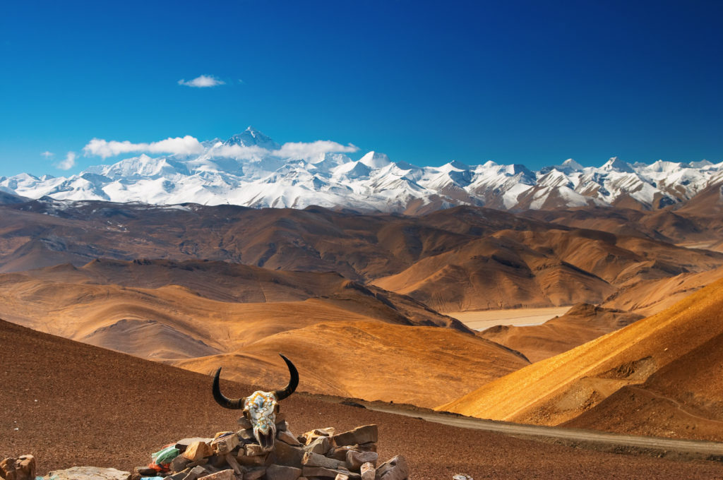
A misconception is that Everest or other peaks of the Himalayas are just right outside of Lhasa or Kathmandu, and that is not true. The Himalayas are still a bit of a journey from the city! To reach the Nepal side of Everest Base Camp, you must trek for around a week from the village of Lukla. To get to the Tibet-side base camp of Everest, you will need at least 2 or 3 days to acclimate in Lhasa and a further 2 days of driving.

Mt. Shisha Pangma, the 14th highest peak on earth, rising to 8013 meters
Mt. Shisha Pangma
As pictured above, Mt. Shisha Pangma is the 14th highest mountain on Earth and the highest mountain located entirely within Tibet. Shisha Pangma is easy to reach. A good view of the peak can be seen from the Tong La Pass along the Friendship Highway. The Tong La Pass rises to 5150 meters, and on a clear day, the views of the mountain are incredible.
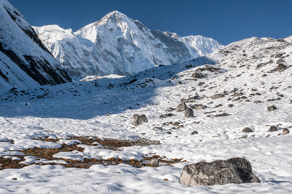
Cho Oyu viewed from near Gokyo, Nepal.
View of Cho Oyu, the 6th highest peak, from Old Tingri, Tibet
Cho Oyu
Cho Oyu is the 6th highest peak on the planet and rises to 8201 meters/26,906 feet. It lies along the border of Tibet and Nepal, though it is climbed from the Tibet side. Excellent views of Cho Oyu can be had from Gokyo, a small village in the Himalaya of Nepal that can only be reached by trekking. The Gokyo Trek is one of the most beautiful trekking routes in all of the Himalaya. Starting and ending in Lukla takes around 12 days to complete and offers stunning mountain views.
The town of Old Tingri, Tibet, also offers a good view of this giant peak. From Old Tingri, you can drive 3 hours to reach the base camp, from where expeditions up the mountain begin. Of the 14 peaks on the planet that rise above 8000 meters, Cho Oyu is considered the least difficult to climb. It was first submitted in October 1954.
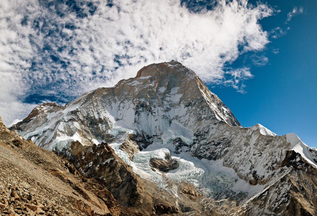
Makalu, the world’s 5th-highest peak
Makalu
Makalu is one of the 14 most beautiful peaks that rise to 8,000 meters or higher. It is located 19 kilometers/12 miles away from Mt. Everest and sits along the Tibet-Nepal border at an elevation of 8485 meters/27,838 feet. It was first submitted in 1955.
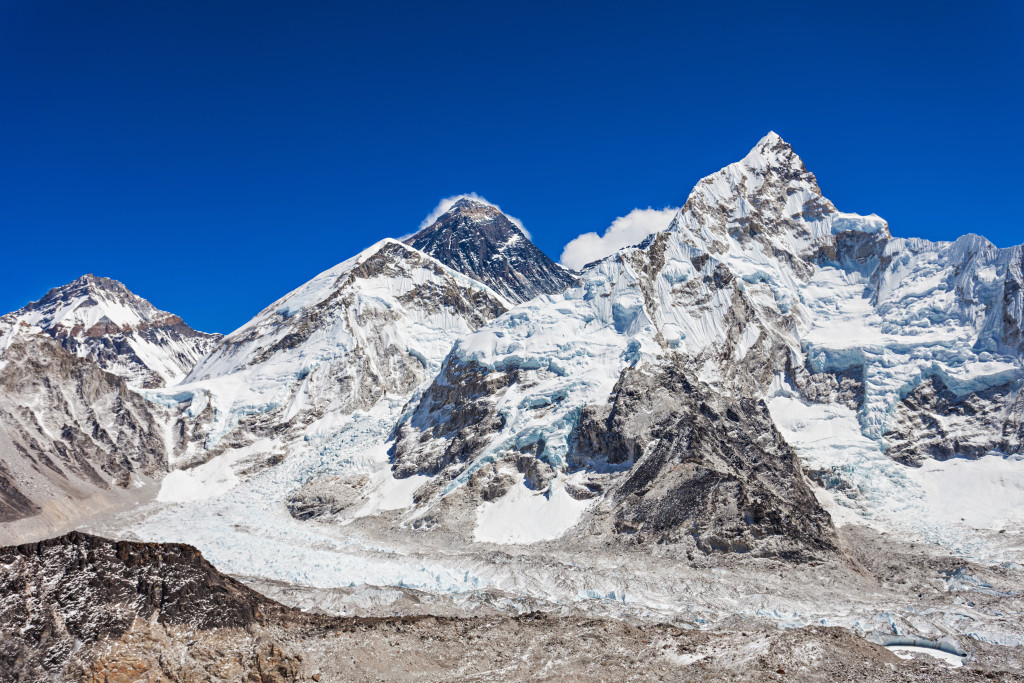
Mt Everest
Everest and other Himalaya giants viewed from Kala Patthar in Nepal
Everest can be view from both the Nepal side of the Himalaya and the Tibet side. Both sides are amazing. From the small mountain of Kala Patthar in Nepal, you get a sweeping view of Everest along with Changtse, Nuptse, and Pumori. There is no better Himalaya view than Kala Patthar! To reach Kala Patthar, you must trek from the small village of Lukla. From Lukla, it will take around 7 or 8 days of hiking to reach Gorak Shep, the nearest town to both Kala Patthar and the Nepal-side Everest Base Camp. From Gorak Shep, it is a steep 90-minute to 2-hour hike up to Kala Patthar, elevation 5545 meters/18,192 feet. Just to let you know, from the Nepal side of Everest Base Camp, you cannot see Everest, though nearby Kala Patthar has excellent views.
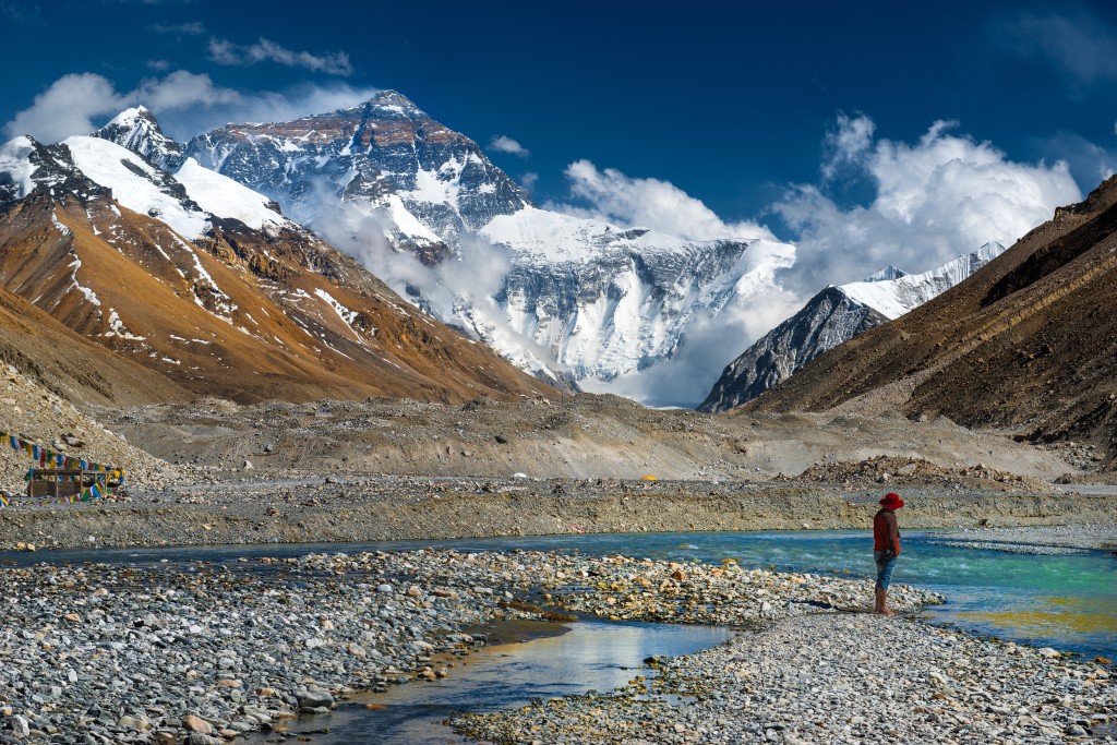
If you are looking for a clear, unobstructed view of Everest, the view from Tibet is where it is! Unlike the Nepal side, no trekking is required to reach the Tibet side of Everest. A road leads all the way to base camp at an elevation of 5200 meters/17,060 feet. You get an excellent, clear view of the world’s highest peak from here. It is essential to acclimate before setting off for the Tibet-side base camp. I recommend taking at least 2 or 3 days to acclimate in Lhasa before going to higher elevations. I recommend taking 5 to 7 days to reach the Tibet side of Everest safely.
For information about trekking in Nepal or Tibet, please email me at: Contact Us or info@thelandofsnows.com
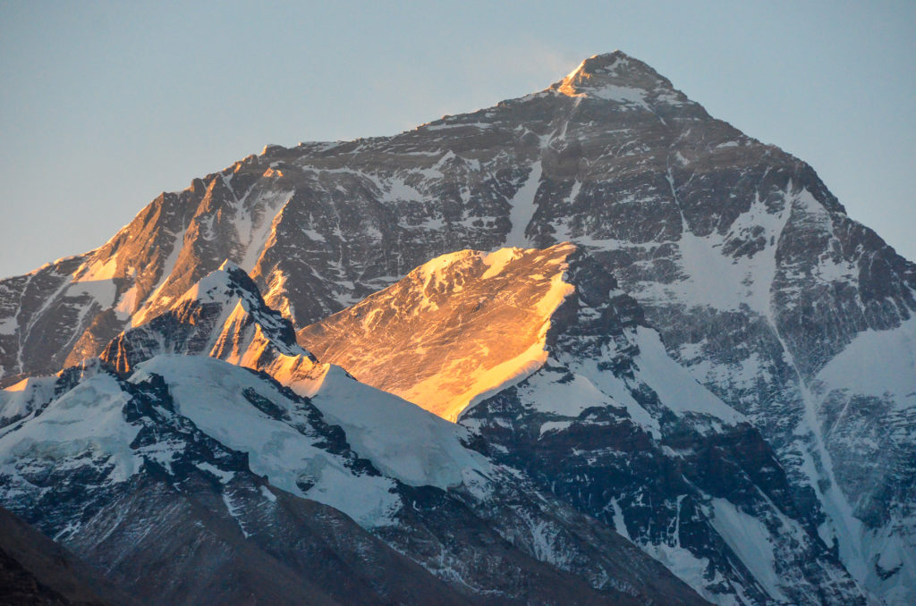
The sun rising on the Tibet side of Everest. The photo was taken from Rongphu Monastery.
Everest viewed from near the Tibet-side base camp
Trekking in Nepal
Of the five countries where the Himalaya Mountains are found, the best trekking is in Nepal. You will have a fantastic adventure if you are trekking in Dolpo, Upper Mustang, Langtang, Annapurna, or the Everest Region. Of all the trekking regions of Nepal, the most popular is the Annapurna Region. The starting point for trekking in the Annapurna region is the city of Pokhara, located in central Nepal. The Annapurna Region offers treks ranging from 4 days to Poon Hill to 18 days if you do the complete Annapurna Circuit Trek.
The second most popular trekking region is the Everest Region. There are several excellent treks to take, including the Everest Base Camp Trek (13 to 15 days in length), the Gokyo Trek (12 days), and the prestigious Three Passes Trek (18 to 20 days in length). The main starting point for trekking in the Everest Region is the village of Lukla, which can be reach by flight from Kathmandu.
The best months to trek in Tibet are mid-March through mid-May and early October through early December. The monsoon months of June, July, and August are not ideal for trekking. For more information about trekking in Nepal, please send me an email at: Contact Us or info@thelandofsnows.com
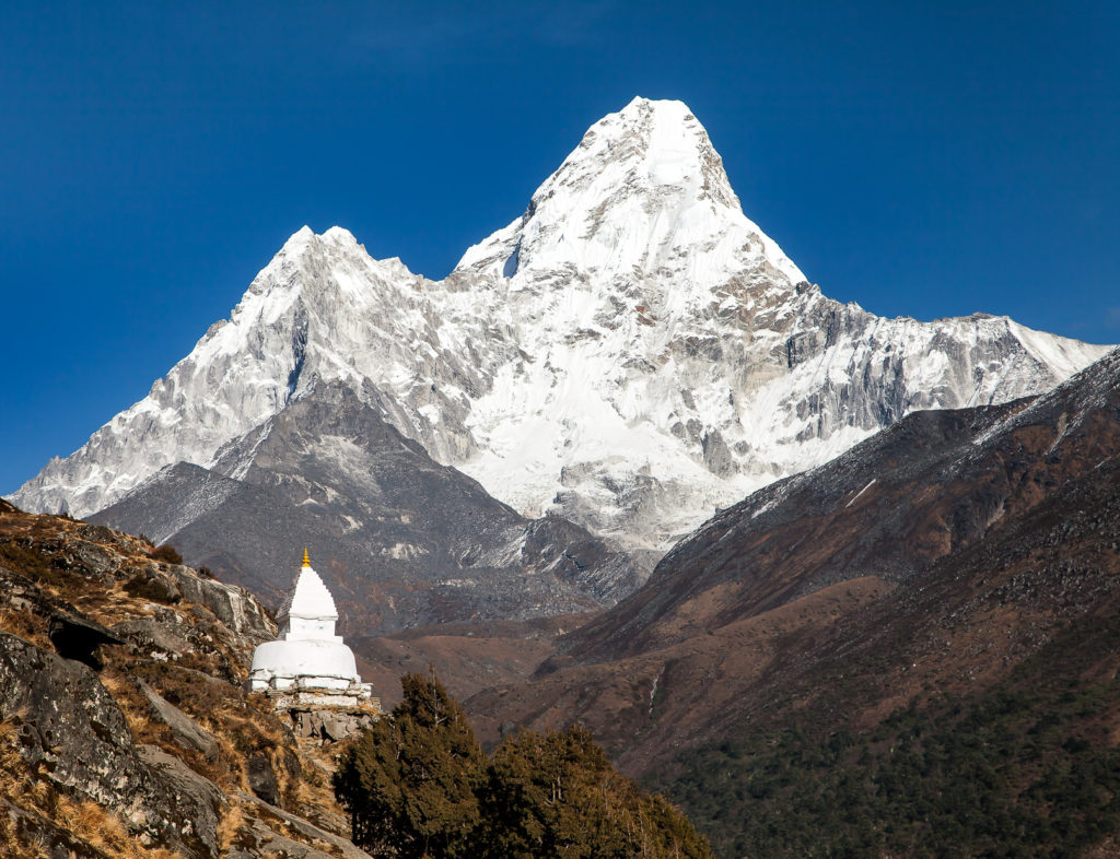
Ama Dablam is one of the most beautiful Himalayan peaks in Nepal. This is a short trek above the town of Namche Bazaar.
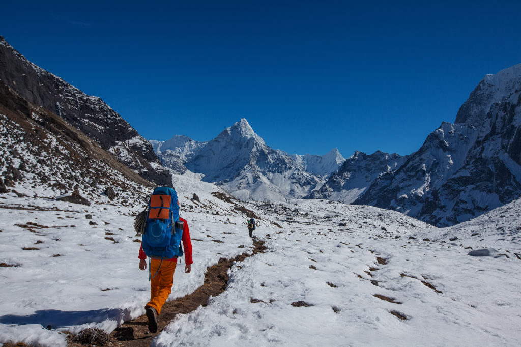
Trekking in the Everest Region of Nepal. This is along the Three Passes Trek below the Cho La Pass.
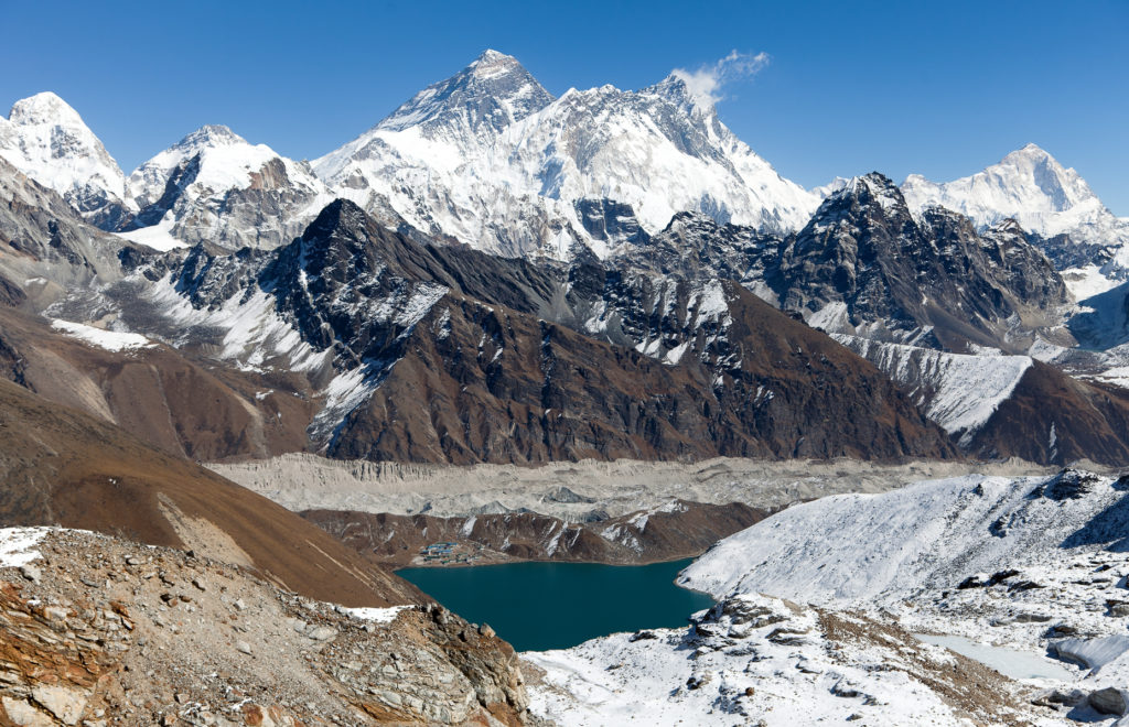
Everest and Gokyo Lake viewed from the Renjo La Pass in Nepal
Ladakh and Little Tibet
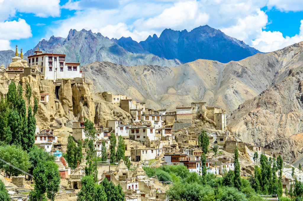
Ladakh is located in far northern India and is often call “Little Tibet”. The culture, language, and religion of the Ladakhi people are all very similar to what is in Tibet. The Himalaya Mountains are found throughout Ladakh and offer excellent trekking and climbing. The starting point in Ladakh is the small town of Leh, which serves as the capital. You can reach Leh by road in the summer months and by flight from Delhi all year round. I’d like you to please read the following link to learn how to Travel to Ladakh.
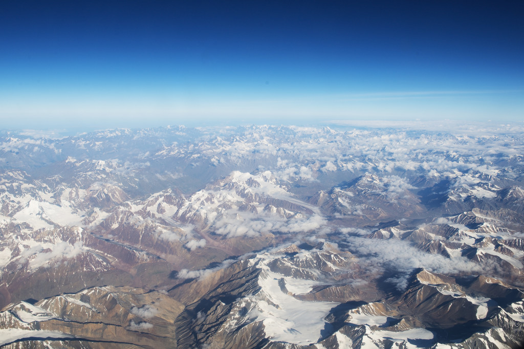
Flying over the Himalayas
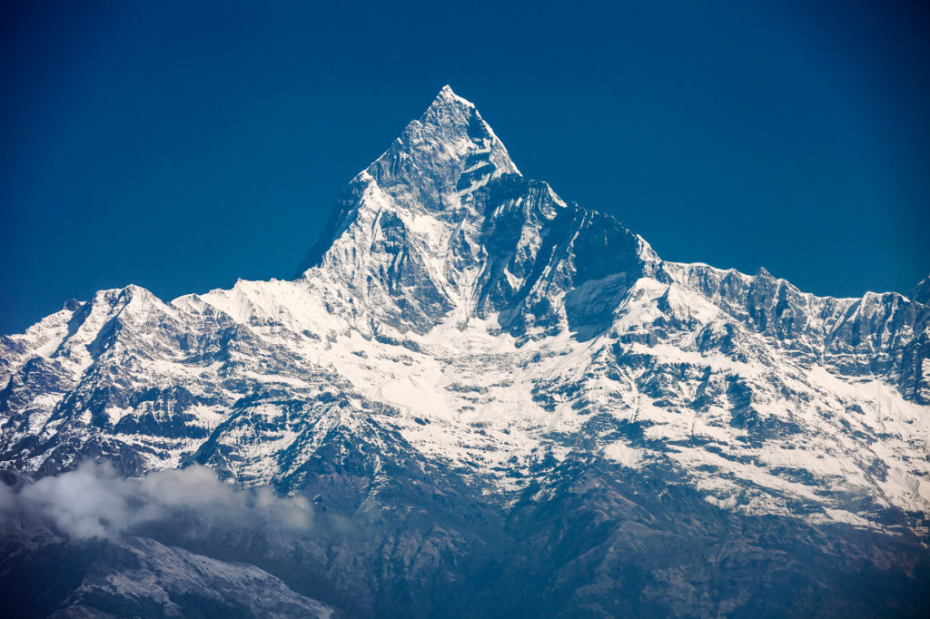
Machapuchare is located in the Annapurna Region of the Nepal Himalaya
Bhutan
Bhutan is a tiny landlocked nation in the eastern Himalayas. Its population is only 750,000. Like Tibet, all foreign travelers to Bhutan must be on a pre-arranged, organized tour through a travel agency. Bhutan has an amazing preserved Buddhist culture, beautiful architecture, great mountain treks, and some great views of the Himalayas. For detailed information on how to get to Bhutan, please read this link: How to get to Bhutan.
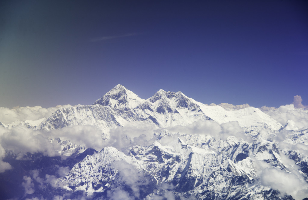
The view of Everest on the flight to Bhutan
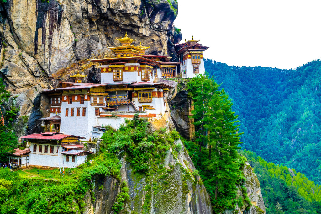
Taktsang Monastery in Bhutan is one of the most iconic places in the Himalayas.
More Information on the Himalaya Mountains
I have spent nearly 15 years traveling and living in the Greater Himalaya Region of Asia. I have traveled extensively across Tibet, Bhutan, Ladakh, Sikkim, and Nepal and am happy to answer any questions about trekking, climbing, and traveling in these areas. I can arrange a high-quality tour or put you in contact with reputable local agencies. For more information, please send me an email at: Contact Us or info@thelandofsnows.com
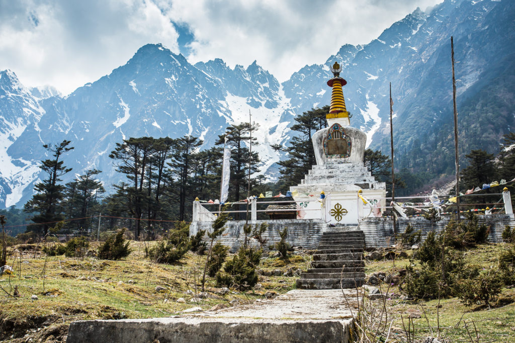
The Himalayas are viewe from Sikkim in northern India.
Lamayuru in Ladakh, India. The Himalayas rise in the distance.