
A few years ago, I went on a journey searching for the holy mountain of Gado Jowa སྒ་སྟོད་ཇོ་བོ་. Most people are only familiar with one or two of Tibet’s many holy mountains. Mt. Kailash གངས་རིན་པོ་ཆེ་ in far western Tibet’s Ngari prefecture is the most well known, followed by Amnye Machen ཨ་མྱིས་རྨ་ཆེན་ in Golok (southeast Qinghai), Minyak Gongkar མི་ཉག་གངས་དཀར་ in Garze (western Sichuan) and Kawa Kharpo ཁ་བ་དཀར་པོ་ in Dechen (northwest Yunnan. But, most of Tibet’s dozens of other holy mountains are virtually unknown to non-Tibetans. Gado Jowa is the most important holy mountain in the northern Kham region. It is located in Yushu prefecture ཡུལ་ཤུལ་ཁུལ་ in the remote nomadic county of Trindu ཁྲི་འདུ་རྫོང་, known as Chengduo in Chinese.
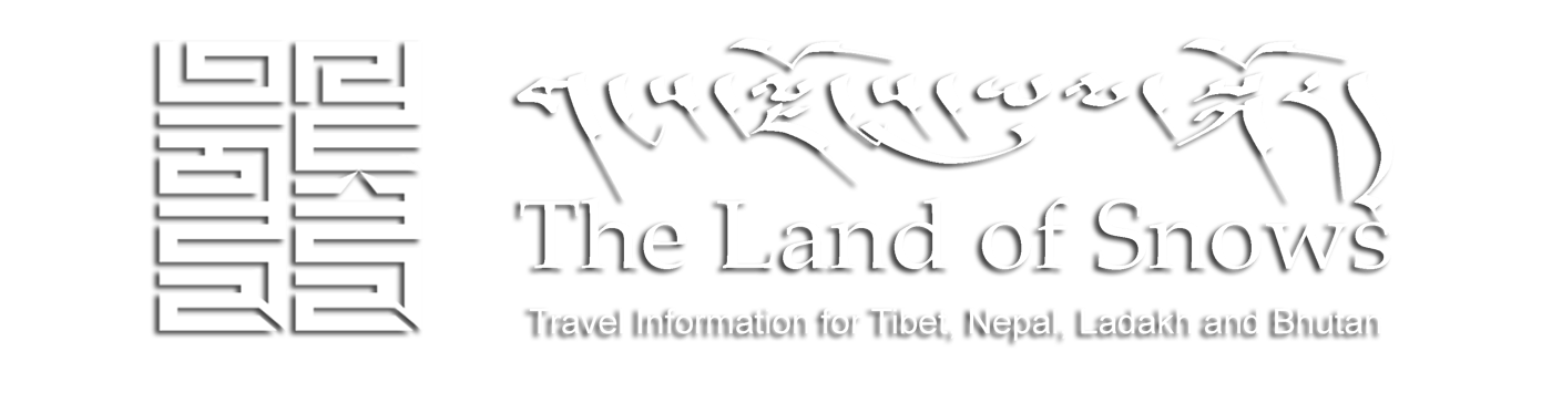
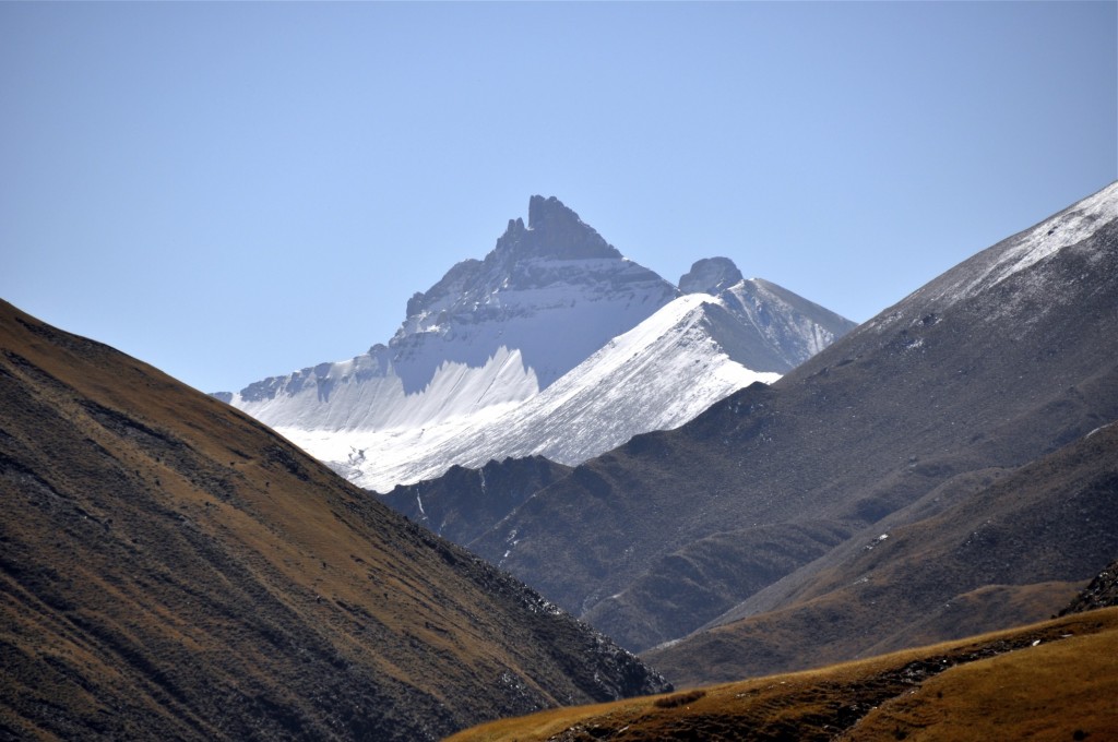
The snow-covered peak of Gado Jowa
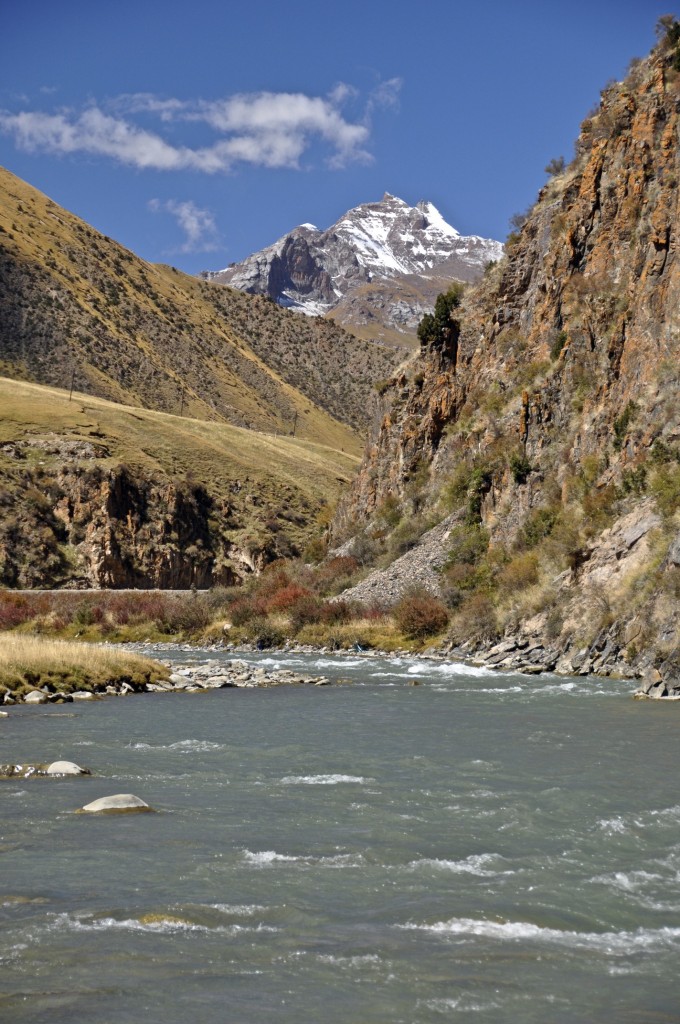
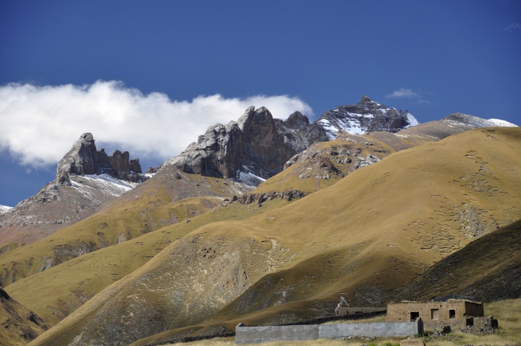
A unique mountain near Gado Jowa
My journey to Gado Jowa began in the Yushu prefectural capital of Jyekundo. The easiest way to get to Gado Jowa would be to head north from Jyekundo, but for this journey, I went northwest to Drido county འབྲི་སྟོད་རྫོང་, known as Zhiduo in Chinese. In Drido, I stayed at my old Tibetan teachers home for the night. I have several good friends from this rugged and remote region that I was happy to see. After a night in Drido, I was off in search of Gado Jowa.
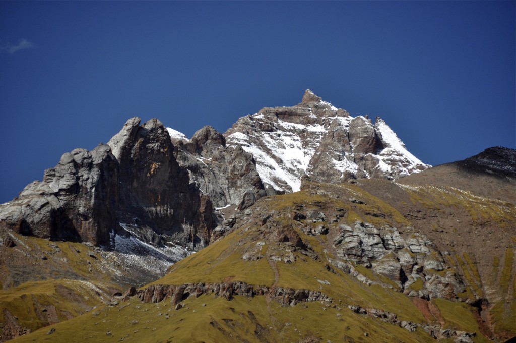
I had calculated that from Drido to the base of the mountain was roughly 215 kms (135 miles). This region is extremely remote and lies at an average elevation of 4300m (14,100 feet). The highest pass rises to 4812m (15,800 feet). Even in early October, the morning temperature was around -15C (5F). All of my bottled water in my SUV was frozen solid as were most of the food items I had. About 40 kilometers outside of Drido, I crossed over the first major bridge of the Yangtze River འབྲི་ཆུ་. The river already was beginning to freeze. Large chunks of ice were floating down the river. Most of the road was newly paved. Even with the good road, I only rarely came across another vehicle. This area of far northern Kham is very sparsely populated with only a few small villages. Fortunately, I filled my SUV with gas when I left Drido because I never came across a fuel station along this route.
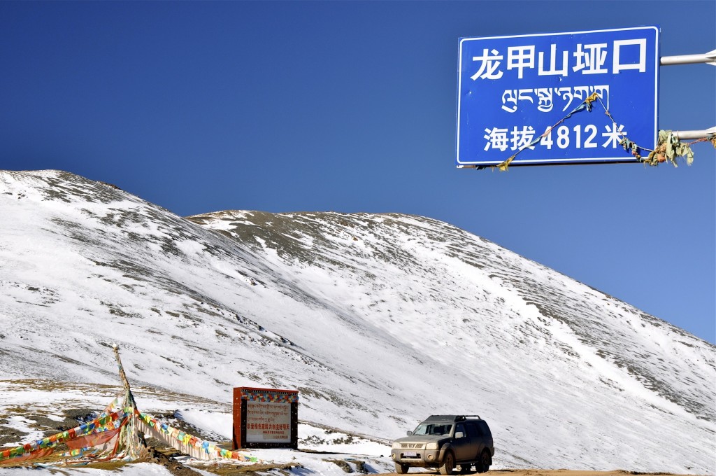
4812 meter/15,790 foot pass along the way to Gado Jowa
The region around Gado Jowa is rugged. It is mostly high altitude grasslands with gently sloping mountains everywhere. This time of year (October), these mountains are all snow-capped. Large herds of yaks are everywhere along with gazelle, marmots, wolves and occasionally wild donkeys. Few foreigners have traveled along this route. Until just recently, the only way to get here was by a rough dirt road. Now, the road is over 90% paved. I was traveling at a good rate of speed when I noticed that my SUV was pulling to one direction. I stopped and checked my tires. Sure enough, the rear driver side tire was flat. I was still roughly 125 kms (78 miles) from the nearest town where it could be repaired. It was the first flat tire I had had on my 2010 Nissan Paladin. The spare tire had never been used. After changing the tire, I was on my way.
Shortly after the small town of Bagan in southeastern Chumarleb county ཆུ་དམར་ལེབ་རྫོང་, I caught my first glimpse of Gado Jowa. Though I had traveled this same route before, the last time it was snowing heavily making it impossible to see the mountain. This time though, the skies were cloudless. I could see all of the mountain as I looked at its western face. The mountain was covered in snow. The peak was jagged and triangular. I looked at my road atlas to find the best road that would take me close to the peak. I was using a detailed atlas that listed each county of the prefecture. Though it was written in Chinese, I knew most of the place names from years of studying the region. According to my map, I needed to go from Bagan to another small town called Zaduo. Zaduo was just inside of Trindu county coming from the west. Zaduo is a very small and dirty place. It has one road that runs through town. During the 1950’s and 1960’s, gold was found in this region. Abandoned gold mining equipment can be found throughout the area.

The dirt road leading up to Gado Jowa
When I reached Zaduo, I turned south off of the main road toward the town of Gado. I could see some of Gado Jowa, but was unsure about which road to take to get closer. I passed another vehicle with 4 passengers and asked them where to go. The four of them discussed the matter in Tibetan and then answered me in Chinese that the best way to get to the mountain was not from the Gado side, but from the Bagan side, which I had just come from 2 hours earlier. I asked them if there was any road on this side that would take me closer, but they didn’t know of any. I decided to keep looking on my own. I turned down a narrow, rough, dirt road that went towards the direction of Gado Jowa. I drove down the road for about 4 kms and then the mountain appeared unobstructed.
Gado Jowa isn’t particularly high. It rises to around 5425m (17,800 feet). Though this would be an extremely high mountain in all other regions on earth, the Tibetan Plateau literally has many hundreds of mountains that are higher than this. To the Kham Tibetan people of this area, Gado Jowa is home to a protector deity. Each year, thousands of Tibetan Buddhist pilgrims set out to hike around the mountain. While it takes only a few days to complete the circuit of the mountain by hiking, many Tibetans prefer to prostrate around the mountain. Every third step they prostrate all the way to the ground causing the journey to take well over a week to complete.
Small village beneath the mountain
The snow covered back side of Gado Jowa
If you are looking for a Tibetan experience that is way off the beaten path, consider Gado Jowa and the far northern regions of Kham found in Yushu prefecture. This area is amazingly beautiful, is not listed in any guidebooks and is 100% Tibetan. There is no public transportation to Gado Jowa. Because of the high elevation in this area (average of 4300m), it is best to travel here by private vehicle in case of altitude related illness. There are a couple of very good travel agencies that know this area well. If you are interested in using their services to travel or trek in this region, please contact me. You can also contact me if you have any questions regarding travel in Tibet. My email address is: thelandofsnows@gmail.com
Hello!
I’m really fascinated by this article!
Hope to make Gado Jowa my next destination for the next Tibet trip!
So, just a few questions:
1. Does this mountain fave a chinese name?
2. What map did you use during your trip?
Thanks alot,
Dmitry